...FLASH FLOOD WATCH IN EFFECT FROM FRIDAY AFTERNOON THROUGH LATE
SATURDAY NIGHT...
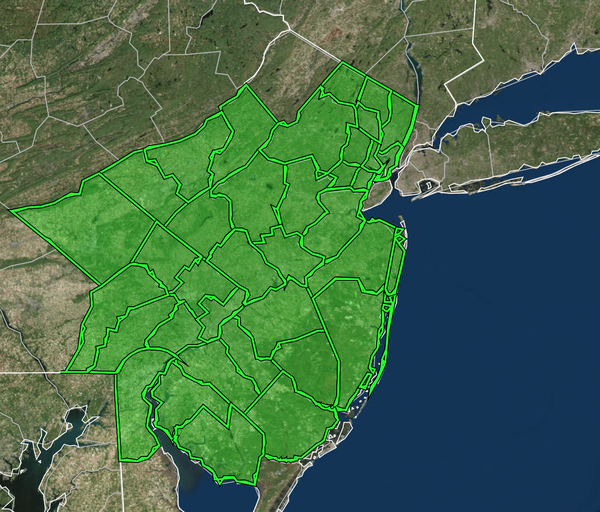
The National Weather Service in Mount Holly has issued a
* Flash Flood Watch for portions of northern Delaware...New Jersey...
and Pennsylvania...including the following areas...in northern
Delaware...New Castle. In New Jersey...Atlantic, Camden, Coastal
Ocean, Cumberland, Eastern Monmouth, Gloucester, Hunterdon,
Mercer, Middlesex, Morris, Northwestern Burlington, Ocean, Salem,
Somerset, Southeastern Burlington, Warren, and Western Monmouth.
In Pennsylvania...Berks, Delaware, Eastern Chester, Eastern
Montgomery, Lehigh, Lower Bucks, Northampton, Philadelphia, Upper
Bucks, Western Chester, and Western Montgomery.
* From Friday afternoon through late Saturday night.
* A slow moving frontal boundary will move into a warm and very
humid air mass by Friday afternoon. This will likely trigger
multiple rounds of thunderstorms from Friday afternoon through
much of Saturday. Storms are likely to be slow moving and produce
torrential rain. A general 1 to 3 inches of rain is forecast, but
locally higher totals over 5 inches are possible. Combined with
wet antecedent conditions, this could lead to flash flooding.
...FLASH FLOOD WATCH IN EFFECT FROM FRIDAY AFTERNOON THROUGH LATE
SATURDAY NIGHT...

The National Weather Service in Upton has issued a

* Flash Flood Watch for a portion of northeast New Jersey, including
  the following areas, Eastern Bergen, Eastern Essex, Eastern
  Passaic, Eastern Union, Hudson, Western Bergen, Western Essex,
  Western Passaic and Western Union.

* From Friday afternoon through late Saturday night.

* A moist environment with slow moving convection may result in a
  quick 1 to 2 inches of rain from Friday afternoon through Saturday
  night. With recent heavy rainfall, it won`t take much additional
  rain to result in flash flooding.