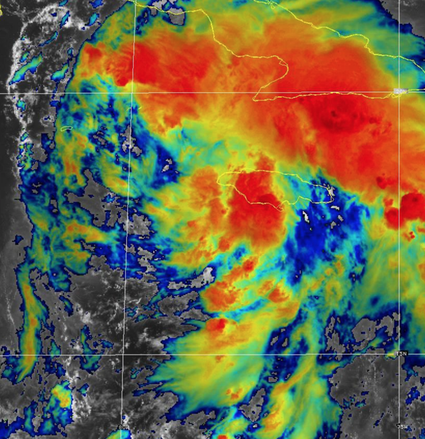
We officially have Tropical Depression Nine as of 11 AM this morning. TD Nine's center of circulation is located on the southwest side of most of the convection this morning. However, given the declining shear and very warm waters ahead of the tropical depression, I expect further strengthening and organization. We'll likely have Tropical Storm Ida by this afternoon or evening. Overall, my thoughts from this morning have not
changed.
Model data suggests that TD Nine will track to the north of the Yucatan Peninsula and then move into the Gulf of Mexico by this weekend. The current guidance supports an environment perfect for rapid intensification with low shear, no dry air impacts, and sea surface temperatures in the mid-80s. These conditions are why most model data supports the development of a major hurricane. The only factor that I would consider an inhibiting
factor would be if the low-level and mid-level structures are not vertically aligned, thus limiting the potential for the warm-core low-pressure system. Otherwise, this storm, which will track around the building western Atlantic ridge, would be a significant threat to the northeastern Texas and Louisianna coast. I should note that the agreement of the model guidance, take your pick, all focus on this area for a landfall early next week.
The remnants of TD Nine will have the potential to influence the weather pattern for the northern Mid-Atlantic by the middle to end of next week with heavy rainfall.