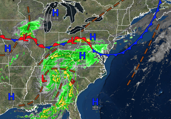
The rainstorm borne out of the remnants of Ida is organizing as forecasted and on track to have significant impacts on the region. Here is what can be expected.
Tonight-Tomorrow: Increasing clouds with scattered showers developing after midnight. Random showers are capable of heavy downpours.
Tomorrow Afternoon: Showers increase coverage, become widespread towards evening. Thunderstorms, possibly severe, are a threat for southern New Jersey. Thunderstorms are capable of heavy downpours, frequent lightning, wind gusts over 40 mph, and tornadoes.
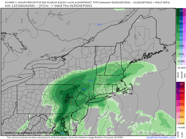
Tomorrow evening through Thursday morning: Intense heavy rainfall, especially along and north of the I-95 corridor. Winds will back from the southeast to the northwest at 10 to 20 mph with gusts over 40 mph at times.
Thursday afternoon: Showers exit from west to east with winds from the northwest at 10 to 20 mph with gusts over 40 mph at times.
IMPACTS: Expected rainfall of 1" to 3" in southeastern New Jersey and 3" to 6" with isolated higher amounts everywhere else. Flash flooding, urban flooding, visibility below a mile, wind damage, downed trees, and power outages are expected.