Tranquil conditions today will give way to the threat of showers and thunderstorms by tomorrow evening. A few thunderstorms may reach severe levels where flash flooding and urban flooding are a threat.
TODAY
High pressure will pass over the region with clear skies to scattered cloud cover. Winds will develop out of the southwest at 5 to 10 mph. Temperatures will rise into the mid to upper 70s over the interior and upper 70s to lower 80s along the coast for highs.
TONIGHT
High pressure will exit with increasing clouds towards morning. Winds will be from the southwest at 5 to 15 mph. Temperatures will fall into the lower to mid-60s over the interior and mid to upper 60s along the coast for lows.
TOMORROW
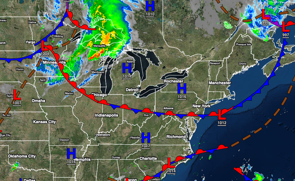
A cold front will approach while a warm front lifts north producing scattered showers and thunderstorms in the afternoon and evening hours. The thunderstorms will be capable of reach severe levels with heavy downpours, frequent lightning, wind gusts over 60 mph, and isolated tornadoes. The showers and thunderstorms may produce localized flash flooding and urban flooding. Winds will be from the southwest at 5 to 15 mph. Temperatures will
rise into the mid to upper 70s over the interior, upper 70s to lower 80s along the coast, and lower to mid-80s in the Delaware River Valley for highs.
TOMORROW NIGHT THROUGH THURSDAY
The cold front will slowly move through the region with periods of showers through Thursday afternoon. Skies will clear towards Thursday evening. Winds will veer from the southwest to the northwest at 5 to 15 mph. Temperatures will range from the lower to mid-60s over the interior and upper 60s to lower 70s along the coast for lows and upper 60s to lower 70s over the interior and lower to mid-70s along the coast for highs.
FRIDAY THROUGH SUNDAY
High pressure will be in control with clear skies to scattered cloud cover. Temperatures on Friday and Saturday will range from the lower to mid-50s over the interior and mid-50s to lower 60s along the coast for lows and mid-60s to lower 70s over the interior, lower to mid-70s along the coast, and mid to upper 70s in the Delaware River Valley for highs. Temperatures on Sunday will range from the upper 50s to lower 60s over the interior and mid to upper
60s along the coast for lows and mid to upper 70s over the interior, upper 70s to lower 80s along the coast, and lower to mid-80s in the Delaware River Valley for highs.
MONDAY THROUGH TUESDAY
A cold front will move through the region Monday afternoon through Tuesday morning with periods of showers and thunderstorms. Skies will clear towards Tuesday afternoon and evening. Temperatures on Monday will range from the mid to upper 60s for lows and lower to mid-80s over the interior and along the coast and upper 80s to lower 90s in the Delaware River Valley for highs. Temperatures on Tuesday will range from the lower to mid-60s over the
interior and mid to upper 60s along the coast for lows and upper 70s to lower 80s along the coast and over the interior and mid to upper 80s in the Delaware River Valley for highs.