An active weather pattern has returned with a threat for showers and thunderstorms each day through next week.
TODAY
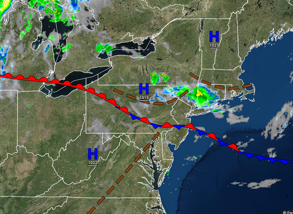
A stationary frontal boundary will linger over the region with scattered to broken cloud cover along with isolated showers. Winds will be light and variable. Temperatures will rise into the mid-70s to lower 80s along the coast, upper 70s to lower 80s over the interior, and lower to mid-80s in the Delaware River Valley for highs.
TONIGHT
The frontal boundary will lift to the north as a warm front with scattered clouds and isolated showers. Fog will be a threat towards the morning hours. Winds will be from the south at 5 to 15 mph. Temperatures will fall into the upper 60s to lower 70s for lows.
TOMORROW
The frontal boundary will drop south as a cold front with waves of showers and thunderstorms in the late afternoon and evening. The thunderstorms will be capable of heavy downpours, frequent lightning, small hail, and wind gusts over 40 mph. Winds will be from the south at 5 to 15 mph. Temperatures will rise into the upper 70s to lower 80s along the coast, lower to mid-80s over the interior, and mid to upper 80s in the Delaware River Valley for
highs.
THURSDAY THROUGH FRIDAY
The cold front will stall over the region with waves of low pressure producing broken to overcast cloud cover and periods of showers, heavy at times. Winds will back to the east at 5 to 15 mph. Temperatures on Thursday and Friday will range from the mid to upper 60s over the interior and upper 60s to lower 70s along the coast for lows and mid-70s to lower 80s for highs.
SATURDAY THROUGH TUESDAY
A stationary front will linger over the region Saturday through Tuesday with scattered to broken cloud cover and isolated showers a threat each day. Temperatures through the period will range from the lower to mid-60s over the interior and mid to upper 60s along the coast and upper 70s to lower 80s for highs.