After a cold front passage today, tranquil conditions return with a cool maritime airmass feel. Heavy rainfall potential returns by the end of next week.
TODAY
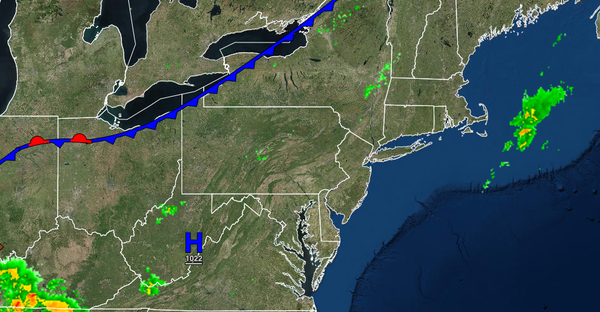
A cold front will move through the region today with scattered to broken cloud cover and a few isolated showers. The showers will be capable of brief heavy downpours. Winds will veer from the northwest to the north at 5 to 10 mph. Temperatures will rise into the upper 70s to lower 80s over the interior and lower to mid-80s along the coast for highs.
TONIGHT
High pressure will build into the region with clearing skies. Winds will veer from the north to the northeast at 5 to 10 mph. Temperatures will fall into the lower to mid-50s over the interior and upper 50s to mid-60s along the coast for lows.
TOMORROW THROUGH TUESDAY
High pressure will build south from New England through the forecast period with clear skies to scattered clouds. Winds will veer from the northeast to east at 5 to 10 mph tomorrow and remain from the east at 5 to 15 mph through Tuesday. Temperatures tomorrow will rise into the lower to mid-70s over the interior, mid to upper 70s along the coast, and upper 70s to lower 80s in the Delaware River Valley. Temperatures Monday and Tuesday will range
from the lower to mid-50s over the interior and upper 50s to lower 60s along the coast for lows and upper 60s to lower 70s over the interior and along the coast and mid to upper 70s in the Delaware River Valley for highs.
WEDNESDAY
High pressure will exit the region with increasing cloud cover and isolated showers towards the afternoon and evening hours. Temperatures will range from the mid to upper 50s over the interior and upper 50s to lower 60s along the coast for lows and lower to mid-70s over the interior and coast and mid to upper 70s in the Delaware River Valley for highs.
THURSDAY AND FRIDAY
A cold front will slowly move through the region on Thursday and Friday with waves of showers and a few thunderstorms. Heavy rainfall is expected with 0.50" to 1.50" of rain expected. Some localized urban flooding and flash flooding are a threat, especially on Friday afternoon with the cold front passage. Temperatures on Thursday will range from the mid to upper 60s for lows and mid to upper 70s for highs. Temperatures on Friday will range
from the mid to upper 50s over the interior, upper 50s to lower 60s in the Delaware River Valley, and mid-60s to lower 70s along the coast for lows and mid-60s to lower 70s over the interior and lower to mid-70s along the coast for highs.
SATURDAY
High pressure will build into the region with clearing skies. Temperatures will range from the upper 40s to lower 50s over the interior and lower to mid-50s along the coast for lows and upper 60s to lower 70s over the interior and lower to mid-70s along the coast for highs.