As a cold front slowly exits the region this morning, clearing skies invade from the west. Drier weather conditions settle in for the weekend.
TODAY
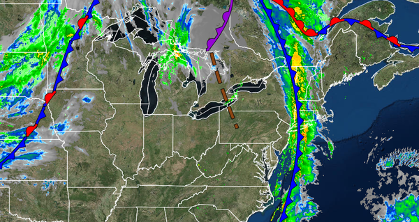
A cold front will continue to slowly push to the east this morning with waves of heavy rainfall and embedded thunderstorms over Long Island and Connecticut while skies clear to the west over the rest of the region. Scattered clouds with a few isolated showers along the coast will be expected by this afternoon. Winds will veer to the west at 5 to 15 mph. Temperatures will rise into the mid to upper 60s over the interior, mid-60s to lower 70s along
the coast, and lower to mid-70s in the Delaware River Valley for highs.
TONIGHT THROUGH TOMORROW
The cold front will stall over the coastal water with scattered clouds expected throughout the region along with the threat for a few isolated showers, especially along the coast. Winds will be from the west at 5 to 15 mph. Temperatures will range from the upper 40s to lower 50s over the interior and suburbs and mid to upper 50s along the coast for lows and lower to mid-70s for highs.
SUNDAY
A cold front will follow with scattered clouds and a few isolated showers. Winds will be from the west at 5 to 15 mph. Temperatures will range from the lower to mid-50s over the interior and suburbs and upper 50s to lower 60s along the coast for lows and mid to upper 60s over the interior and lower to mid-70s along the coast for highs.
MONDAY
High pressure will produce scattered cloud cover. Temperatures will range from the upper 40s to lower 50s over the interior and mid to upper 50s along the coast for lows and mid to upper 60s over the interior and lower to mid-70s along the coast for highs.
TUESDAY THROUGH FRIDAY
A series of weak cold fronts and troughs will pass through the region with scattered clouds and isolated showers. Temperatures on Tuesday will range from the mid-50s to lower 60s for lows and upper 60s to lower 70s over the interior, lower to mid-70s along the coast, and mid-70s to lower 80s in the Delaware River Valley for highs. Temperatures on Wednesday and Thursday will range from the mid-40s to the lower 50s over the interior and mid-50s to lower
60s along the coast for lows and mid to upper 60s over the interior, upper 60s to lower 70s along the coast, and lower to mid-70s in the Delaware River Valley for highs. Temperatures on Friday will range from the lower to mid-50s over the interior and upper 50s to lower 60s along the coast for lows and upper 60s to lower 70s for highs.