As a stationary boundary sinks south, the maritime air mass returns once again plenty of low clouds and pesky showers into the weekend.
TODAY
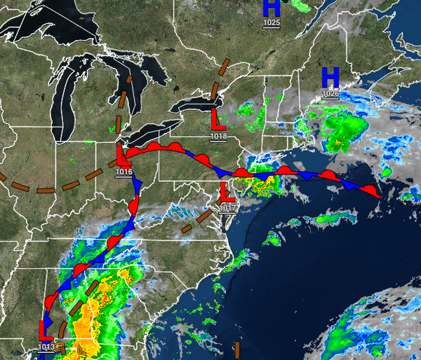
A stationary front will drift south today with showers and thunderstorms sinking south through the Philadelphia metropolitan area, central New Jersey, and southern New Jersey through this morning. As the boundary drift south, scattered to broken cloud cover is expected throughout the region with a few isolated to widely scattered showers possible. Winds will be from the northeast at 5 to 15 mph. Temperatures will rise into the upper 60s to lower
70s throughout much of the region, but lower to mid-70s over southern New Jersey.
TONIGHT THROUGH THURSDAY
High pressure to the north and a stationary front to the south will produce scattered to broken cloud cover, areas of fog in the morning, drizzle, and isolated to widely scattered showers. Winds will be from the northeast at 5 to 15 mph. Temperatures tomorrow will range from the upper 50s to lower 60s for lows and lower to mid-70s for highs. Temperatures on Thursday will range from the upper 50s to lower 60s lows and lower to mid-70s for
highs.
FRIDAY AND SATURDAY
The stationary front will remain over the coastal waters while high pressure remains to the north with scattered to broken clouds and a few isolated showers. Temperatures on Friday will range from the mid-50s to lower 60s for lows and mid to upper 70s for highs. Temperatures on Saturday will range from the lower to mid-60s for lows and mid to upper 60s over the interior, upper 60s to lower 70s along the coast, and lower to mid-70s in the Delaware River
Valley for highs.
SUNDAY
An area of low pressure over the region's coastal waters will produce periods of showers, heavy at times. Temperatures will range from the mid to upper 50s over the interior and lower to mid-60s along the coast for lows and upper 60s to mid-70s for highs.
MONDAY AND TUESDAY
Waves of low pressure along the stationary front will produce scattered to broken cloud cover along with scattered to widespread showers. Temperatures on Monday will range from the upper 50s to lower 60s over the interior and lower to mid-60s along the coast for lows and lower to mid-70s for highs. Temperatures on Tuesday will range from the lower to mid-60s for lows and mid to upper 60s over the interior and upper 60s to lower 70s along the coast for
highs.