A maritime air mass will remain in place through the week cloudy skies and pesky showers. A new coastal low is a threat for this weekend.
TODAY THROUGH TOMORROW
Overcast to broken cloud cover is expected through tomorrow with a few isolated showers. Winds will be from the northeast at 5 to 15 mph. Temperatures today will rise into the upper 60s to lower 70s for highs. Temperatures tomorrow will range from the upper 50s to lower 60s for lows and lower to mid-70s for highs.
FRIDAY
Scattered to broken cloud cover is expected with a few isolated showers. Winds will be light and variable. Temperatures will range from the mid to upper 50s over the interior and upper 50s to lower 60s along the coast for lows and lower to mid-70s over the interior and mid to upper 70s along the coast for highs.
SATURDAY AND SUNDAY
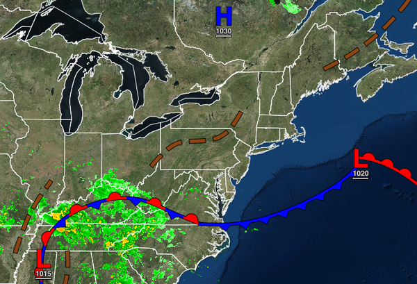
An area of low pressure will slowly develop over the coastal waters with overcast skies and scattered to widespread showers capable of heavy downpours at times. Windy conditions and minor coastal flooding will be a threat. Temperatures will range from the mid to upper 50s over the interior and lower to mid-60s along the coast for lows and lower to mid-60s over the interior, mid to upper 60s along the coast, and upper 60s to lower 70s in the Delaware
River Valley for highs.
MONDAY THROUGH WEDNESDAY
A stationary front will linger over the coastal waters with waves of low pressure producing scattered to broken cloud cover along with isolated showers. Temperatures will range from the lower to mid-50s over the interior and upper 50s to lower 60s along the coast for lows and lower to mid-70s over the interior, mid to upper 70s along the coast, and upper 70s to lower 80s in the Delaware River Valley for highs.