A brief period of Summer-like weather will come to a crashing halt on Saturday afternoon and evening. A more seasonable weather pattern returns next week.
TODAY
Low clouds and patchy fog will give way to scattered clouds this afternoon. Winds will back from the northwest to the west at 5 to 10 mph. Temperatures will rise into the lower to mid-70s for highs.
TONIGHT THROUGH FRIDAY
High pressure off the coast will produce clear skies to scattered cloud cover through Friday. Winds will be from the southwest at 5 to 15 mph. Temperatures tomorrow will range from the mid to upper 50s over the interior and upper 50s to lower 60s along the coast for lows and lower to mid-70s over the interior, mid to upper 70s along the coast, and upper 70s to lower 80s in the Delaware River Valley for highs. Temperatures on Friday will range
from the mid to upper 50s over the interior and upper 50s to lower 60s along the coast for lows and lower to mid-70s over the interior, mid to upper 70s along the coast, and upper 70s to lower 80s in the Delaware River Valley for highs.
SATURDAY
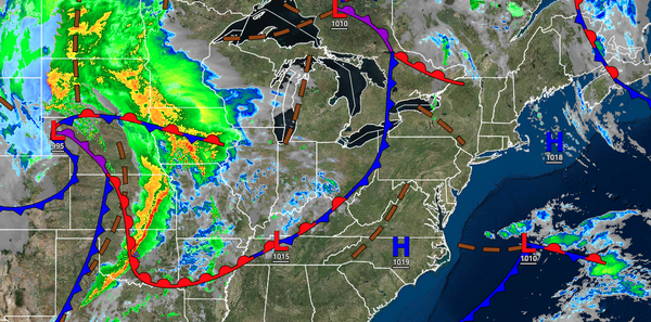
A strong cold front will move through the region in the afternoon and evening hours with increasing clouds and widely scattered showers in the morning giving way to widespread heavy rainfall and embedded thunderstorms. The thunderstorms will be capable of heavy downpours, occasional lightning, and wind gusts over 40 mph. Breezy conditions are expected through the evening. Temperatures will range from the lower to mid-60s over the interior and mid
to upper 60s along the coast for lows and lower to mid-70s over the interior, mid to upper 70s along the coast, and upper 70s to mid-80s in the Delaware River Valley for highs.
SUNDAY
High pressure will build into the region with clearing skies and breezy conditions. Temperatures will range from the mid to upper 40s over the interior and lower to mid-50s along the coast for lows and upper 50s to lower 60s over the interior and lower to mid-60s along the coast for highs.
MONDAY THROUGH WEDNESDAY
High pressure will be in control through the forecast period with clear skies to scattered cloud cover. Temperatures on Monday and Tuesday will range from the lower to mid-40s over the interior and mid-40s to lower 50s along the coast for lows and upper 50s to lower 60s over the interior, lower to mid-60s along the coast, and mid-60s to lower 70s in the Delaware River Valley for highs. Temperatures on Wednesday will range from the lower to mid-50s for
lows and mid to upper 60s over the interior and lower to mid-70s along the coast and Delaware River Valley for highs.