A stormy weather pattern is unfolding throughout the end of October into November that will bring intense rainfall, strong winds, and coastal flooding. Two storms are expected this week.
TODAY
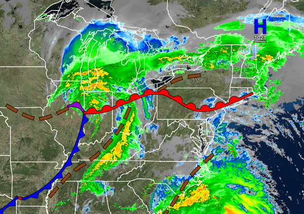
A warm front will continue to lift northward through the region with scattered to broken clouds and isolated showers through this afternoon. Winds will be from the south at 5 to 15 mph. Temperatures will rise into the mid to upper 60s over the interior, upper 60s to lower 70s in the New York City metropolitan area, and mid to upper 70s in the Philadelphia metropolitan area for highs.
TONIGHT
The area of low pressure in the Ohio River Valley will redevelop off the southern New Jersey coast this evening through tomorrow morning with periods of rain expected, heavy at times. Winds will back from the southeast to the northeast at 5 to 15 mph. Temperatures will fall into the lower to mid-50s over the interior and upper 50s to lower 60s along the coast for lows.
TOMORROW
The area of low pressure will intensify over the New Jersey coastal waters and south of Long Island with waves of moderate to very heavy rainfall. Rainfall amounts of 2" to 4" with locally higher amounts are expected throughout the region. Flash flooding and urban flooding are a threat. Winds will back from the northeast to the northwest at 10 to 20 mph with gusts over 30 mph away from the coast and 15 to 30 mph with gusts up to 50 mph along the
coast. Minor coastal flooding is a threat. Temperatures will rise into the mid to upper 50s over the interior and lower to mid-60s along the coast for highs.
WEDNESDAY
The low-pressure system will exit on Wednesday morning with lingering showers followed by clearing skies in the afternoon and evening. Winds will be from the north-northwest at 10 to 20 mph. Temperatures will range from the upper 40s to mid-50s for lows and upper 50s to lower 60s over the interior, lower to mid-60s along the coast, and mid to upper 60s in the Delaware River Valley for highs.
THURSDAY
High pressure will produce clear skies to scattered cloud cover. Temperatures will range from the upper 30s to mid-40s over the interior and upper 40s to lower 50s along the coast for lows and upper 50s to lower 60s for highs.
FRIDAY
An area of low pressure will approach with increasing clouds and isolated showers. Temperatures will range from the mid to upper 40s over the interior and upper 40s to mid-50s along the coast for lows and upper 40s to lower 50s over the interior and mid to upper 50s along the coast for highs.
SATURDAY
An area of low pressure will produce moderate to heavy rainfall and windy conditions. Temperatures will range from the mid to upper 40s over the interior and upper 40s to lower 50s along the coast for lows and lower to mid-50s over the interior and upper 50s to mid-60s along the coast for highs.
HALLOWEEN SUNDAY
Clearing skies are expected with breezy conditions. Temperatures will range from the mid to upper 40s over the interior and upper 40s to lower 50s along the coast for lows and upper 50s to lower 60s for highs.
MONDAY
Scattered clouds are expected. Temperatures will range from the upper 30s to the lower 40s over the interior and mid to upper 40s along the coast for lows and lower to mid-50s over the interior and mid to upper 50s along the coast for highs.