Arctic air begins to exit but the damage is already done. Improving conditions will follow next week but some wintry mischief may be brewing for next weekend.
TODAY
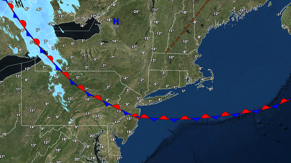
As high pressure drifts over the region, scattered clouds are expected.
Winds will be from the northwest at 5 to 15 mph. Temperatures will rise into the lower to mid-20s over the interior and mid-20s to lower 30s along the coast for highs by this evening.
TONIGHT
High pressure will exit the region with scattered clouds. Winds will back to the southwest at 5 to 15 mph. Temperatures will hold in the lower to mid-20s over the
interior and mid-20s to lower 30s along the coast for lows.
TOMORROW
High pressure will produce clear skies to scattered clouds. Winds will be from the southwest at 5 to 15 mph. Temperatures will rise into the mid to upper 40s for highs.
TOMORROW
NIGHT
High pressure will produce clear skies to scattered clouds. Winds will be from the southwest at 5 to 15 mph. Temperatures will fall into the upper 20s to lower 30s over the interior and lower to mid-30s along the coast for lows.
MONDAY
High pressure will produce scattered to broken cloud
cover. Winds will be from the northwest at 5 to 10 mph. Temperatures will rise into the upper 30s to mid-40s over the interior and upper 40s to lower 50s along the coast for highs.
TUESDAY
A cold front will approach the region with increasing clouds. Winds will veer to the south at 5 to 10 mph. Temperatures will range from the lower to mid-20s
over the interior and mid to upper 20s along the coast for lows and lower to mid-40s over the interior and mid to upper 40s along the coast for highs.
WEDNESDAY
A weak trough will produce scattered to broken clouds with isolated showers. Temperatures will range from the upper 20s to lower 30s over the interior and mid to upper 30s along the coast for lows and mid
to upper 40s over the interior and upper 40s to lower 50s along the coast for highs.
THURSDAY
A warm front will lift through the region with scattered showers. Temperatures will range from the lower to mid-30s over the interior and mid to upper 30s along the coast for lows and upper 40s to lower 50s over the interior and lower to mid-50s along the coast for
highs.
FRIDAY
A stationary front will produce scattered to broken clouds with isolated showers. Temperatures will range from the lower to mid-30s over the interior and upper 30s to mid-40s along the coast for lows and mid to upper 40s over the interior and lower to mid-50s in the New York City metropolitan area, and mid-50s to lower 60s in the Philadelphia
metropolitan area for highs.
SATURDAY
An area of low pressure will pass through the coastal waters with periods of snow and sleet over the higher elevations, a wintry mix of snow, sleet, and rain northwest of the I-95 corridor, and a mix of snow and rain along and east of the I-95 corridor. Temperatures will range from the upper 20s to lower 30s over the interior
and mid to upper 30s along the coast for lows and lower to mid-30s over the interior and mid to upper 30s along the coast for highs.