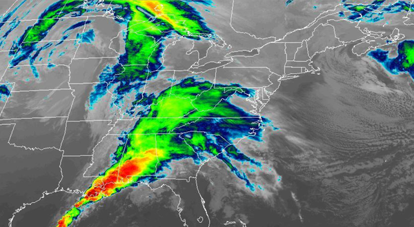
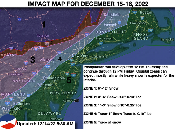
A winter storm is on the way that will produce a variety of impacts on the region tomorrow through Friday. Colder weather will follow with a return to below-normal temperatures.
TONIGHT
Clouds will continue
to increase through the overnight hours. Winds will veer to the north at 5 to 15 mph. Temperatures will fall into the lower to mid-10s over the interior, upper 10s to mid-20s in the suburbs, and upper 20s to lower 30s in urban areas for lows.
TOMORROW
An area of low pressure will approach the region with a warm front producing increasing clouds through the
afternoon. Rain will develop in the evening along the coast while a mix of snow, sleet, and rain will develop over the interior. Winds will veer to the northeast at 10 to 20 mph. Temperatures will rise into the lower to mid-30s over the interior and upper 30s to mid-40s along the coast for highs.
TOMORROW NIGHT
Periods of snow will continue in the
Catskills and Poconos while a wintry mix of snow, sleet, and rain will transition to rain over the northwestern suburbs of Philadelphia and New York City. Periods of rain will continue elsewhere. Winds will be from the east at 10 to 20 mph with gusts up to 50 mph. Temperatures will hold in the lower to mid-30s in the Catskills and Poconos, upper 30s to mid-40s in the suburbs, and mid-40s to lower 50s along the coast for lows.
FRIDAY
The low-pressure system will lift toward New England with periods of snow and sleet slowly ending in the Poconos and Catskills while a wintry mix ends as snow for the northwestern suburbs of Philadelphia and New York City. The rain along the coast will taper off to snow showers by the late evening. Winds will back from the east at 10 to 20 mph with gusts up to 50 mph to the northwest
at 10 to 20 mph. Temperatures will hold in the mid to upper 30s over the interior and lower 40s to lower 50s along the coast for highs and then fall through the 40s, 30s, and 20s in the evening.