A warm and wet weather pattern will start the first week of 2023, but cold conditions return by the end of the week.
TODAY
High pressure will exit the region with increasing clouds. Winds will be from the
southwest at 5 to 15 mph. Temperatures will rise into the upper 40s to lower 50s over the interior and mid to upper 50s along the coast for highs.
TONIGHT
High pressure will exit the region with increasing clouds. Winds will be from the southwest at 5 to 15 mph. Temperatures will fall into the mid to upper 30s for lows.
TOMORROW
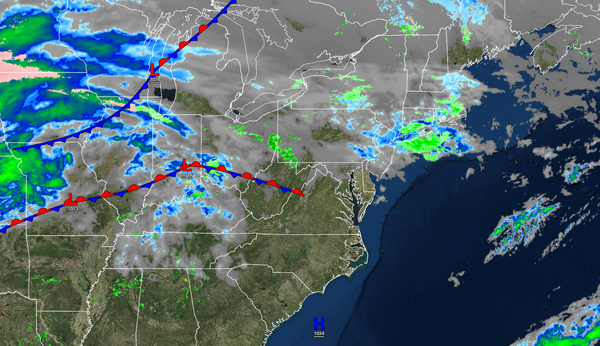
A warm front will produce periods of showers. Winds will be from the southwest at 5 to 15 mph. Temperatures will rise into the lower to mid-50s over the interior and mid to upper 50s along the coast for highs.
TOMORROW NIGHT
A warm front will produce
periods of showers. Winds will be from the southwest at 5 to 15 mph. Temperatures will fall into the lower to mid-50s over the interior and mid to upper 50s along the coast for lows.
WEDNESDAY
An area of low pressure will produce periods of rain, heavy at times. Winds will be from the southwest at 5 to 15 mph. Temperatures will rise into the upper
50s to lower 60s for highs.
THURSDAY
The area of low pressure will linger over the coastal waters with rain and snow showers. Temperatures will fall through the 50s, 40s, and 30s throughout the day.
FRIDAY
A series of troughs will produce
scattered snow showers with some minor snow accumulation possible. Temperatures will range from the upper 20s to the lower 30s for lows and the lower to mid-30s over the interior and upper 30s to lower 40s for highs.
SATURDAY
High pressure will produce scattered clouds. Temperatures will range from the lower to mid-20s over the interior and upper 20s to lower
30s along the coast for lows and lower to mid-30s over the interior and upper 30s to lower 40s along the coast for highs.
SUNDAY
High pressure will produce scattered clouds. Temperatures will range from the upper 10s to the lower 20s over the interior and lower to mid-20s along the coast for lows and mid to upper 30s for highs.
MONDAY
High pressure will produce scattered clouds. Temperatures will range from the upper 10s to the lower 20s over the interior and lower to mid-20s along the coast for lows and lower to mid-30s for highs.