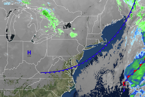
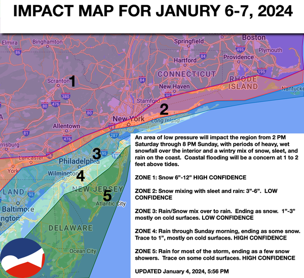
Tranquil conditions will end the week, but a powerful winter storm with impacts ranging from heavy snowfall to driving rainfall by this weekend.
TONIGHT
High pressure will be in control with scattered clouds. Winds will
be from the west at 5 to 15 mph. Temperatures will fall into the upper 10s to mid-20s for lows.
TOMORROW
High pressure will be in control with scattered clouds. Winds will be from the west at 5 to 15 mph. Temperatures will rise into the lower to mid-30s over the interior and mid to upper 30s along the coast for
highs.
TOMORROW NIGHT
High pressure will be in control with scattered clouds. Winds will be from the northwest at 5 to 15 mph. Temperatures will fall into the mid to upper 20s for lows.
THROUGH NOON SATURDAY
Clouds will increase from the south with winds veering from the northwest to east-northeast at 5 to 15 mph. Temperatures will rise into the upper 20s to lower 30s over the interior and lower to mid-30s along the coast.
12 PM THROUGH 5 PM SATURDAY
Overcast skies with developing rainfall over
southern New Jersey and snowfall for the rest of the region can be expected. Winds will be from the east-northeast at 10 to 20 mph. Temperatures will rise into the lower to mid-30s over the interior and mid to upper 30s along the coast for highs.
5 PM SATURDAY THROUGH MIDNIGHT SUNDAY
Waves of rainfall can be expected throughout
southern New Jersey and the central New Jersey coast. Meanwhile, a winter mix of snow, sleet, and rain can be expected along the I-95 corridor. Periods of heavy, wet snow will continue north and northwest of the I-95 corridor. Winds will back to the north-northeast at 10 to 20 mph. Temperatures will hold in the lower to mid-30s over the interior and mid to upper 30s along the coast.
12 AM SUNDAY
THROUGH 6 AM SUNDAY
Waves of rainfall can be expected throughout southern New Jersey and the central New Jersey coast. Meanwhile, a winter mix of snow, sleet, and rain will mix to snow along the I-95 corridor. Periods of heavy, wet snow will continue north and northwest of the I-95 corridor. Winds will back to the north at 10 to 20 mph. Temperatures will fall into the upper 20s to lower 30s
over the interior and mid to upper 30s along the coast.
6 AM THROUGH 4 PM SUNDAY
Periods of heavy snow will continue over the interior while the wintry mix and rain will change over to snow along the coast. Winds will back to the northwest at 10 to 20 mph. Temperatures will fall steadily through the 30s into the 20s.
4 PM THROUGH 8 PM SUNDAY
The snow will taper off to snow showers from west to east. Winds will be from the northwest at 10 to 20 mph. Temperatures will continue to fall through the 20s.