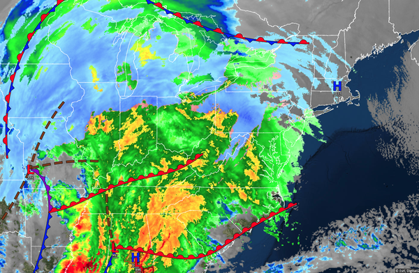
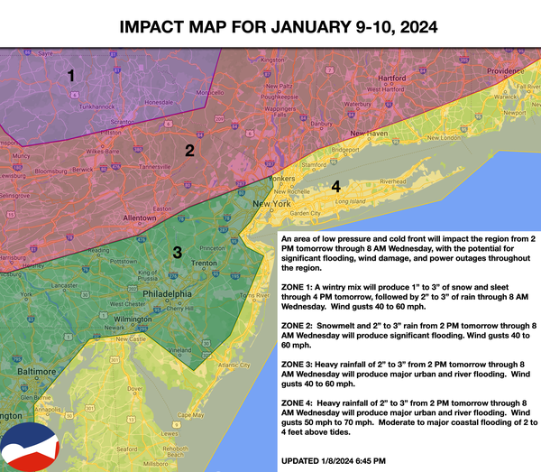
A powerful storm is on the way that will produce heavy rainfall, flash flooding, and powerful winds this afternoon through tomorrow morning. An active weather pattern with a series of storms will continue through next week.
TODAY
Clouds will increase in the morning. A wintry mix of snow, sleet, and rain will mix over to rain in the Poconos and Catskills, while rain will develop elsewhere in the afternoon. Winds will be from the east at 10 to 20 mph, with gusts increasing to over 40 mph by the evening. Temperatures will rise into the lower to mid-50s over the interior and mid to upper 50s along the coast for highs by the evening.
TONIGHT
The area of low pressure will lift through the region with periods of heavy rain that will produce the threat of flooding, wind damage, and power outages. Winds will veer from the southeast at 15 to 30 mph to the southwest at 10 to 20 mph, with gusts over 40 mph. Temperatures will fall into the mid-30s to lower 40s over the interior and mid to upper 40s
along the coast for lows.
TOMORROW
The area of low pressure will lift through the region with periods of heavy rain that will produce the threat of flooding, wind damage, and power outages in the morning. Winds will be from the southwest at 10 to 20 mph, with gusts over 40 mph. Temperatures will rise into the upper 30s to mid-40s
over the interior and upper 40s to lower 50s along the coast for morning highs. Temperatures will fall through the 40s and 30s in the afternoon and evening.
TOMORROW NIGHT
High pressure will produce scattered cloud cover. Winds will be from the southwest at 5 to 15 mph. Temperatures will fall into the upper 20s to lower 30s
over the interior and lower to mid-30s along the coast for lows.
THURSDAY
High pressure will produce scattered cloud cover. Winds will be from the southwest at 5 to 15 mph. Temperatures will rise into the lower to mid-40s over the interior and upper 40s to lower 50s along the coast for highs.