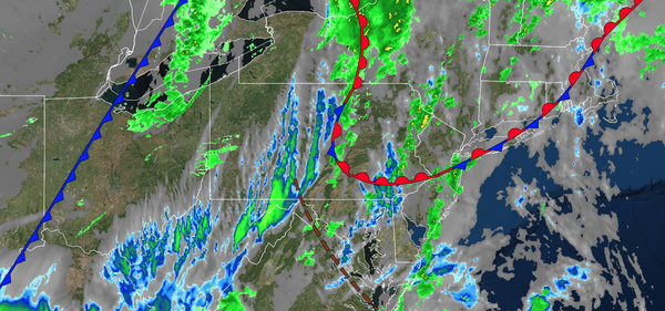
A stormy end to March will unfold today with heavy rain, strong winds, and a few thunderstorms. The volatile weather pattern will continue through the week and into next weekend!
TODAY
A warm front will lift through the
region with variable clouds and widely scattered showers. A cold front will follow with waves of showers and thunderstorms in the afternoon and evening. A few thunderstorms in eastern Pennsylvania will reach severe levels with frequent lightning, hail, and wind gusts over 50 mph. Winds will be from the southwest at 10 to 20 mph. High temperatures will range from the upper 50s to the lower 60s on Long Island, mid to upper 60s along the immediate coast, lower to mid-70s in
the Delaware River Valley, and upper 60s to lower 70s throughout the rest of the region.
TONIGHT
The cold front will move through the region with heavy rain and embedded thunderstorms. The thunderstorms will feature occasional lightning, and wind gusts over 40 mph. Skies will clear towards daybreak. Winds will veer
from the southwest to the northwest at 5 to 15 mph. Low temperatures will range from the lower to mid-30s over the interior and the upper 30s to the lower 40s along the coast.
TOMORROW
High pressure will produce scattered clouds. Winds will be from the northwest at 5 to 15 mph. High temperatures will range from the lower to
mid-40s over the interior, upper 40s to lower 50s in the New York City metropolitan area, and lower to mid-50s in the Philadelphia metropolitan area.
TOMORROW NIGHT
High pressure will produce scattered clouds. Winds will be from the northwest at 5 to 15 mph. Low temperatures will range from the mid to upper 20s over the interior
and lower to mid-30s along the coast.
WEDNESDAY
High pressure will exit the region, producing scattered clouds. Winds will veer from the northwest to the southeast at 5 to 15 mph. High temperatures will range from the mid to upper 40s over the interior and New York City metropolitan area and lower to mid-50s in the Philadelphia
metropolitan area.
THURSDAY
A warm front will lift through the region with increasing clouds and scattered showers. Winds will veer from the southeast to the southwest at 5 to 15 mph. Low temperatures will range from the lower to mid-40s. High temperatures will range from the upper 50s to mid-60s on Long Island, upper 60s
to lower 70s along the coast, and lower to mid-70s away from the coast.
FRIDAY
A cold front will sink south with variable clouds and scattered showers. Low temperatures will range from the upper 40s to the lower 50s over the interior, mid to upper 50s in the suburbs, and upper 50s to the lower 60s in urban areas. High
temperatures will range from the lower to mid-60s over the interior and upper 60s to lower 70s along the coast.
SATURDAY
An area of low pressure and warm front will produce variable clouds, scattered showers, and isolated thunderstorms. Low temperatures will range from the mid to upper 30s over the interior and lower to mid-40s along
the coast. High temperatures will range from the upper 30s to the lower 40s over the interior and mid to upper 40s along the coast.
SUNDAY
A cold front will move through the region with showers and thunderstorms. Low temperatures will range from the mid to upper 30s over the interior and lower to mid-40s along the coast.
High temperatures will range from the lower to mid-60s on Long Island, upper 60s to lower 70s along the coast, lower to mid-70s in the Delaware River Valley, and mid to upper 60s over the interior.
MONDAY
A series of troughs will produce scattered clouds. Low temperatures will range from the mid to upper 30s over the interior, upper
30s to lower 40s in the suburbs, and mid to upper 40s in urban areas and the immediate coast. High temperatures will range from the mid to upper 40s over the interior, lower to mid-50s in the Delaware River Valley, and mid to upper 50s along the coast.