The maritime airmass will finally give way as showers and thunderstorms lift through the region. Additional showers and thunderstorms are a threat tomorrow with a cold front. A heat wave takes hold by next week.
TODAY
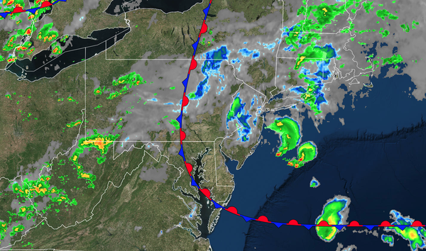
A warm front will lift through the region with scattered showers and thunderstorms. Winds will veer from the southeast to the west at 5 to 10 mph. High temperatures will range from the upper 70s to lower 80s over the interior, upper 70s to lower 80s along the coast, and mid to upper 80s on the I-95 corridor.
TONIGHT
A warm front will continue to lift to the region's north with scattered clouds. Winds will be from the west at 5 to 10 mph. Low temperatures will range from the mid to upper 60s over the interior and upper 60s to lower 70s along the coast.
TOMORROW
A cold front will move through the region
with scattered showers and thunderstorms. A few isolated severe thunderstorms will be possible with heavy downpours, frequent lightning, hail, and wind gusts over 55 mph. Winds will be from the southwest at 5 to 15 mph. High temperatures will range from the upper 70s to lower 80s on Long Island, lower to mid-80s along the coast, upper 80s to lower 90s on the I-95 corridor, and lower to mid-80s over the interior.
TOMORROW NIGHT
High pressure will produce scattered clouds. Winds will be from the west at 5 to 10 mph. Low temperatures will range from the upper 50s to the lower 60s over the interior and mid to upper 60s along the coast.
FRIDAY
A trough will pass through the region with scattered clouds and isolated thunderstorms. Winds will be from the west at 5 to 10 mph. High temperatures will range from the mid to upper 70s over the interior and lower to mid-80s along the coast.
SATURDAY
High pressure will produce scattered
clouds. An isolated thunderstorm will be a threat along the coast. Winds will be from the southwest at 5 to 10 mph. Low temperatures will range from the lower to mid-60s. High temperatures will range from the lower to mid-80s over the interior, lower to mid-80s along the coast, and upper 80s to lower 90s on the I-95 corridor.
SUNDAY
High pressure will produce scattered clouds. An isolated thunderstorm will be a threat along the coast. Low temperatures will range from the mid to upper 60s over the interior, upper 60s to lower 70s in the suburbs, and lower to mid-70s in urban areas. High temperatures will range from the mid to upper 80s over the interior, upper 80s to lower 90s along the coast, and lower to mid-90s on the I-95 corridor. A heat index in the upper
90s to lower 100s is expected.
MONDAY
High pressure will produce scattered clouds. An isolated thunderstorm will be a threat along the coast. Low temperatures will range from the lower to mid-70s over the interior, lower to mid-70s in the suburbs, and mid to upper 70s in urban areas. High temperatures will range from the
upper 80s to lower 90s over the interior, upper 80s to lower 90s along the coast, and mid-90s on the I-95 corridor. A heat index in the 100s is expected.
TUESDAY
High pressure will produce scattered clouds. An isolated thunderstorm will be a threat along the coast. Low temperatures will range from the lower to mid-70s over
the interior, lower to mid-70s in the suburbs, and upper 70s to lower 80s in urban areas. High temperatures will range from the upper 80s to lower 90s over the interior, upper 80s to lower 90s along the coast, and mid-90s on the I-95 corridor. A heat index in the 100s is expected.
WEDNESDAY
High pressure will produce scattered
clouds. An isolated thunderstorm will be a threat along the coast. Low temperatures will range from the lower to mid-70s over the interior, mid to upper 70s in the suburbs, and upper 70s to lower 80s in urban areas. High temperatures will range from the upper 80s to lower 90s over the interior, upper 80s to lower 90s along the coast, and mid-90s on the I-95 corridor. A heat index in the 100s is expected.