The combination of heat and humidity will push the heat index to dangerous levels today, with a heat index well into the 110s! A cold front will produce waves of showers and thunderstorms tomorrow through Friday as this dangerous heatwave comes to an end.
TODAY
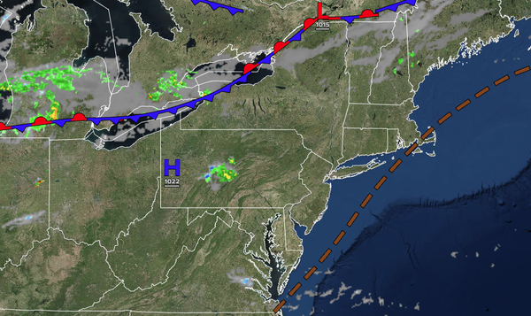
A cold front will approach from the north with showers and thunderstorms by the afternoon and evening. The thunderstorms will be capable of intense downpours, frequent lightning, and wind gusts over 40 mph. Winds will be from the northwest at 1 to 5 mph. High temperatures will range from the upper 80s to lower 90s over the interior, upper 80s to lower 90s along the coast, and mid to upper 90s on the I-95 corridor. A heat index in the
110s is expected.
TONIGHT
A cold front will slowly press into the region with variable clouds and isolated showers. Winds will be from the northwest at 1 to 5 mph. Low temperatures will range from the upper 60s to the lower 70s over the interior, the upper 60s to the lower 70s in the suburbs, and the mid-70s in urban
areas.
TOMORROW
A cold front will move through the region with scattered clouds in the morning and showers and thunderstorms in the afternoon and evening. Winds will be from the northwest at 1 to 5 mph. High temperatures will range from the mid-80s to the lower 90s over the interior, upper 80s to lower 90s on Long Island, lower
to mid-90s along the coast, and mid to upper 90s on the I-95 corridor. A heat index in the 100s is expected.
TOMORROW NIGHT
A stationary front will linger around the region with cloudy skies, drizzle, and scattered showers. Winds will veer to the northeast at 5 to 10 mph. Low temperatures will range from the mid to upper
60s.
FRIDAY
A stationary front will linger around the region with cloudy skies, drizzle, and scattered showers. Winds will veer to the east at 5 to 10 mph. High temperatures will range from the lower to mid-70s.
SATURDAY
A warm front will produce scattered clouds and widely scattered showers. Winds will veer to the southwest at 5 to 10 mph. Low temperatures will range from the mid to upper 60s over the interior, upper 60s to lower 70s in the suburbs, and lower to mid-70s in urban areas. High temperatures will range from the upper 70s to the lower 80s along the
coast, mid to upper 80s on the I-95 corridor, and lower to mid-80s over the interior.
SUNDAY
A cold front will produce scattered clouds and scattered thunderstorms. Low temperatures will range from the mid to upper 60s over the interior, upper 60s to lower 70s in the suburbs, and lower to mid-70s in urban areas. High
temperatures will range from the upper 70s to the lower 80s over the interior, mid to upper 80s on the I-95 corridor, and lower to mid-80s along the coast.
MONDAY
A stationary front will produce scattered clouds and isolated showers. Low temperatures will range from the lower to mid-60s over the interior, mid to upper 60s in the
suburbs, and upper 60s to lower 70s in urban areas. High temperatures will range from the lower to mid-80s along the coast, upper 80s to lower 90s on the I-95 corridor, and mid to upper 80s along the coast.
TUESDAY
A cold front will move through the region with scattered showers and thunderstorms. Low temperatures will range from
the lower to mid-70s. High temperatures will range from the lower to mid-80s.
WEDNESDAY
High pressure will produce scattered clouds. Low temperatures will range from the mid to upper 60s over the interior and lower to mid-70s along the coast. High temperatures will range from the lower to mid-80s over the interior, mid-80s
along the coast, and mid to upper 80s on the I-95 corridor.