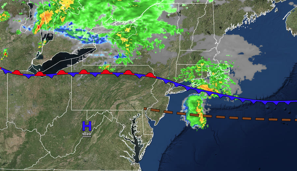
A cold front will produce waves of scattered showers and thunderstorms today as this dangerous heatwave comes to an end from north to south.
TODAY
A cold front will move through the region with scattered clouds, scattered showers,
and scattered thunderstorms. Winds will veer from the northwest to the northeast at 5 mph. High temperatures will range from the upper 70s to mid-80s in Connecticut and Long Island, the lower to mid-80s from the Poconos through New York City and central New Jersey, and upper 80s to lower 90s throughout southeastern Pennsylvania and southern New Jersey.
TONIGHT
A stationary front will linger around the region with cloudy skies, drizzle, and scattered showers. Winds will be from the northeast at 5 to 10 mph. Low temperatures will range from the mid to upper 60s.
TOMORROW
A stationary front will linger around the region with cloudy skies, drizzle, and
scattered showers. Winds will veer to the east at 5 to 10 mph. High temperatures will range from the lower to mid-70s.
TOMORROW NIGHT
A warm front will approach the region with variable clouds and isolated showers. Winds will be from the southeast at 5 to 10 mph. Low temperatures will range from the mid to upper 60s
over the interior, upper 60s to lower 70s in the suburbs, and lower to mid-70s in urban areas.
SATURDAY
A warm front will produce scattered clouds and widely scattered showers. Winds will veer to the southwest at 5 to 10 mph. High temperatures will range from the upper 70s to the lower 80s along the coast, mid to upper 80s on the
I-95 corridor, and lower to mid-80s over the interior.
SUNDAY
A cold front will produce scattered clouds and scattered thunderstorms. Winds will be from the west at 5 to 10 mph. Low temperatures will range from the mid to upper 60s over the interior, upper 60s to lower 70s in the suburbs, and lower to mid-70s in urban
areas. High temperatures will range from the upper 70s to the lower 80s over the interior, mid to upper 80s on the I-95 corridor, and lower to mid-80s along the coast.
MONDAY
A stationary front will produce scattered clouds and isolated showers. Low temperatures will range from the lower to mid-60s over the interior, mid to upper
60s in the suburbs, and upper 60s to lower 70s in urban areas. High temperatures will range from the lower to mid-80s along the coast, upper 80s to lower 90s on the I-95 corridor, and mid to upper 80s along the coast.
TUESDAY
A cold front will move through the region with scattered showers and thunderstorms. Low temperatures will
range from the lower to mid-70s. High temperatures will range from the lower to mid-80s.
WEDNESDAY
High pressure will produce scattered clouds. Low temperatures will range from the mid to upper 60s over the interior and lower to mid-70s along the coast. High temperatures will range from the lower to mid-80s over the
interior, mid-80s along the coast, and mid to upper 80s on the I-95 corridor.
THURSDAY
High pressure will produce scattered clouds. Low temperatures will range from the lower to mid-60s over the interior and upper 60s to lower 70s along the coast. High temperatures will range from the mid to upper 70s over the interior and lower
to mid-80s along the coast.