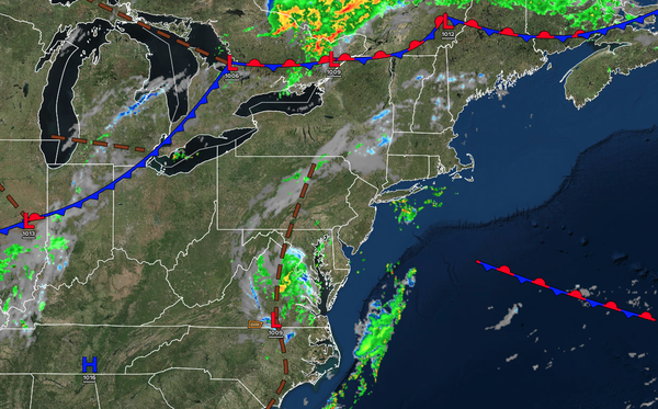
The remnants of Chantal will produce scattered thunderstorms capable of tropical downpours this afternoon and evening. A cold front will keep the weather pattern unsettled through next weekend.
TODAY
The remnants of
Chantal will produce variable clouds, scattered showers, and thunderstorms. The bulk of the thunderstorms will be focused along and southeast of the I-95 corridor. These thunderstorms may produce intense downpours, frequent lightning, and wind gusts over 40 mph. Localized flash flooding will be a threat. Winds will be from the south at 5 to 10 mph. High temperatures will range from the lower to mid-80s along the coast, upper 80s to lower 90s on the I-95 corridor,
and mid to upper 80s over the interior.
TONIGHT
A cold front will approach the region with variable clouds, scattered showers, and isolated thunderstorms. Winds will be from the south at 5 to 10 mph. Low temperatures will range from the upper 60s to the lower 70s over the interior, and from the lower to mid-70s along the
coast.
TOMORROW
The cold front will sink through the region with scattered showers and thunderstorms. A few isolated thunderstorms may reach severe levels with intense downpours, frequent lightning, hail, and wind gusts over 55 mph. Winds will be from the southwest at 5 to 10 mph. High temperatures will range from the mid
to upper 80s over the interior, lower to mid-90s on the I-95 corridor, upper 80s to lower 90s along the coast, and mid to upper 80s on Long Island.
TOMORROW NIGHT
The cold front will stall over the region with variable clouds and widely scattered thunderstorms. Winds will be from the west at 5 to 10 mph. Low temperatures will
range from the lower to mid-60s over the interior, from the upper 60s to the lower 70s in the suburbs, and from the lower to mid-70s in urban areas.
WEDNESDAY
A stalled cold front will produce variable clouds and isolated showers. Winds will be from the west at 1 to 5 mph. High temperatures will range from the lower to mid-80s
over the interior, upper 80s to lower 90s along the I-95 corridor, and mid-to-upper 80s along the coast.
THURSDAY
A stationary front will produce variable clouds and isolated thunderstorms. Winds will be from the south at 5 to 10 mph. Low temperatures will range from the mid- to upper 60s over the interior, from the upper 60s to
the lower 70s in the suburbs, and from the lower to mid-70s in urban areas. High temperatures will range from the upper 70s to the lower 80s along the coast and the lower to mid-80s elsewhere.
FRIDAY
A stationary front will produce variable clouds and isolated thunderstorms. Low temperatures will range from the mid- to upper 60s
over the interior, from the upper 60s to the lower 70s in the suburbs, and from the lower to mid-70s in urban areas. High temperatures will range from the upper 70s to the lower 80s along the coast, mid-to-upper 80s on the I-95 corridor, and lower to mid-80s over the interior.
SATURDAY
A stationary front will produce variable clouds
and isolated thunderstorms. Low temperatures will range from the mid- to upper 60s over the interior, from the upper 60s to the lower 70s in the suburbs, and from the lower to mid-70s in urban areas. High temperatures will range from the upper 70s to the lower 80s on Long Island, from the lower to mid-80s along the coast, from the mid- to upper-80s on the I-95 corridor, and from the lower to mid-80s over the interior.
SUNDAY
A stationary front will produce variable clouds and isolated thunderstorms. Low temperatures will range from the mid-60s to the lower 70s. High temperatures will range from the mid to upper 70s on Long Island, lower to mid-80s along the coast, mid to upper 80s on the I-95 corridor, and lower to mid-80s over the interior.
MONDAY
A stationary front will produce variable clouds and isolated thunderstorms. Low temperatures will range from the mid to upper 60s. High temperatures will range from the lower to mid-80s along the coast, from the upper 80s to the lower 90s on the I-95 corridor, and from the mid-to upper-80s over the interior.