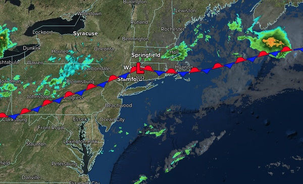
A stationary front will linger over the region with variable clouds and afternoon thunderstorms each day through next week.
TODAY
A stalled cold front will produce variable clouds and isolated showers. Winds will be from
the west at 1 to 5 mph. High temperatures will range from the lower to mid-80s over the interior, mid-to-upper 80s along the coast, and upper 80s to lower 90s on the I-95 corridor.
TONIGHT
A stationary front will produce variable clouds and isolated thunderstorms. Winds will be from the south at 5 to 10 mph. Low
temperatures will range from the mid- to upper 60s over the interior, from the upper 60s to the lower 70s in the suburbs, and from the lower to mid-70s in urban areas.
TOMORROW
A stationary front will produce variable clouds and isolated thunderstorms. Winds will be from the south at 5 to 10 mph. High temperatures will range from
the upper 70s to the lower 80s along the coast and the lower to mid-80s elsewhere.
TOMORROW NIGHT
A stationary front will produce variable clouds and isolated thunderstorms. Winds will be light and variable. Low temperatures will range from the mid- to upper 60s over the interior, from the upper 60s to the lower 70s in the
suburbs, and from the lower to mid-70s in urban areas.
FRIDAY
A stationary front will produce variable clouds and isolated thunderstorms. Winds will be light and variable. High temperatures will range from the upper 70s to lower 80s on Long Island, lower to mid-80s along the coast, upper 80s to lower 90s on the I-95 corridor, and
lower to mid-80s over the interior.
SATURDAY
A stationary front will produce variable clouds and isolated thunderstorms. Winds will be from the east at 1 to 5 mph. Low temperatures will range from the mid- to upper 60s over the interior, from the upper 60s to the lower 70s in the suburbs, and from the lower to mid-70s in urban
areas. High temperatures will range from the lower to mid-80s along the coast, from the mid- to upper-80s on the I-95 corridor, and from the lower to mid-80s over the interior.
SUNDAY
A stationary front will produce variable clouds and isolated thunderstorms. Low temperatures will range from the mid- to upper 60s over the interior,
from the upper 60s to the lower 70s in the suburbs, and from the lower to mid-70s in urban areas. High temperatures will range from the lower to mid-80s along the coast, from the mid- to upper-80s on the I-95 corridor, and from the lower to mid-80s over the interior.
MONDAY
A stationary front will produce variable clouds and isolated
thunderstorms. Low temperatures will range from the mid to upper 60s over the interior, from the upper 60s to the lower 70s in the suburbs, and from the lower to mid-70s in urban areas. High temperatures will range from the upper 70s to the lower 80s along the coast, from the mid to upper 80s on the I-95 corridor, and from the lower to mid-80s over the interior.
TUESDAY
A cold front will produce scattered showers and thunderstorms. Low temperatures will range from the upper 60s to the lower 70s over the interior, and from the lower to mid-70s along the coast. High temperatures will range from the lower to mid-80s along the coast, from the mid to upper 80s on the I-95 corridor, and from the lower to mid-80s over the interior.
WEDNESDAY
A stationary front will produce variable clouds and isolated thunderstorms. Low temperatures will range from the mid to upper 60s over the interior, from the upper 60s to the lower 70s in the suburbs, and from the lower to mid-70s in urban areas. High temperatures will range from the upper 70s to the lower 80s along the coast, from the mid-80s on the I-95
corridor, and from the lower to mid-80s over the interior.