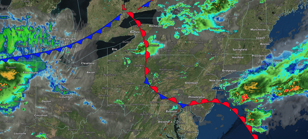
A warm front and a cold front will produce showers and thunderstorms through this evening. Tranquil conditions return for the upcoming week, followed by a new heat wave by the end of the week.
TODAY
A warm front will lift
northward this morning with scattered showers and thunderstorms. A cold front will produce scattered showers and thunderstorms in the afternoon and evening. Winds will veer to the west at 5 to 15 mph. High temperatures will range from the lower to mid-80s over the interior, upper 80s to lower 90s along the I-95 corridor, and mid-to-upper 80s along the coast.
TONIGHT
High pressure will build into the region with clearing skies. Winds will veer to the northwest at 5 to 10 mph. Low temperatures will range from the upper 50s to the lower 60s over the interior, from the lower to mid-60s in the suburbs, and from the mid to upper 60s in urban areas.
TOMORROW
High pressure will produce scattered clouds. Winds will be from the northwest at 5 to 15 mph. High temperatures will range from the mid- to upper 70s over the interior to the lower to mid-80s along the coast.
TOMORROW NIGHT
High pressure will produce scattered clouds. Winds will be from the northeast at 1 to 5 mph. Low temperatures will range from the lower to mid-50s over the interior, from the upper 50s to the lower 60s in the suburbs, and from the lower to mid-60s in urban areas and along the coast.
TUESDAY
High pressure will produce scattered clouds. Winds will be from the northeast at 1 to 5 mph. High temperatures will range from the mid to upper 70s over the interior, lower to mid-80s on the I-95 corridor, and upper 70s to lower 80s along the coast.
WEDNESDAY
High pressure will produce
scattered clouds. Winds will be from the southeast at 1 to 5 mph. Low temperatures will range from the lower to mid-50s over the interior, from the upper 50s to the lower 60s in the suburbs, and from the lower to mid-60s in urban areas and along the coast. High temperatures will range from the lower to mid-80s over the interior, mid-to-upper 80s along the I-95 corridor, and upper 70s to lower 80s along the coast.
THURSDAY
High pressure will produce scattered clouds. Low temperatures will range from the upper 60s to the lower 70s over the interior, from the lower to mid-70s in the suburbs, and from the mid to upper 70s in urban areas. High temperatures will range from the upper 80s to lower 90s over the interior, lower to mid-90s along the I-95 corridor, upper 80s to
lower 90s along the coast, and mid to upper 80s on Long Island. The heat index along the I-95 corridor is expected to range from the upper 90s to the mid-100s.
FRIDAY
A cold front will approach the region with scattered showers and thunderstorms in the afternoon and evening. Low temperatures will range from the lower to mid-70s
over the interior, mid-to-upper 70s in the suburbs, and upper 70s to lower 80s in urban areas. High temperatures will range from the upper 80s to the lower 90s over the interior, mid to upper 90s along the I-95 corridor, and lower to mid-90s along the coast. The heat index is expected to range from the lower 100s to mid-110s.
SATURDAY
A cold front will slowly move through the region with scattered showers and thunderstorms. Low temperatures will range from the upper 60s to the lower 70s over the interior and mid to upper 70s along the coast. High temperatures will range from the mid-80s to the lower 90s over the interior, mid-to-upper 90s on the I-95 corridor, and lower to mid-90s along the coast. The heat index is expected to range from the lower 100s to mid-110s along
the I-95 corridor.
SUNDAY
The cold front will stall over the region with scattered showers and thunderstorms. Low temperatures will range from the upper 60s to the lower 70s over the interior, and from the lower to mid-70s along the coast. High temperatures will range from the mid- to upper 80s over the interior, mid- to upper
80s on Long Island, upper 80s to lower 90s in the New York City metropolitan area, and mid- to upper 90s in the Philadelphia metropolitan area and southern New Jersey.