An onshore influence today will produce variable clouds and isolated showers. Waves of showers and thunderstorms follow tomorrow. More heat for next week!
TODAY
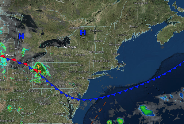
A cold front will stall to the south of the region
with variable clouds and isolated to widely scattered showers. Winds will veer from the west to the northeast at 1 to 5 mph. High temperatures will range from the lower to mid-80s over the interior and upper 80s to lower 90s along the coast.
TONIGHT
The stationary front will produce variable clouds and isolated showers.
Winds will be from the southeast at 1 to 5 mph. Low temperatures will range from the upper 60s to the lower 70s over the interior and from the lower to mid-70s along the coast.
TOMORROW
The stationary front will rebound as a warm front in the morning with scattered showers and thunderstorms. A cold front is expected to follow in
the afternoon, accompanied by additional showers and thunderstorms. Winds will veer to the south at 5 to 10 mph. High temperatures will range from the lower to mid-80s over the interior, mid to upper 80s on the I-95 corridor, lower to mid-80s along the coast, and mid to upper 70s on Long Island.
TOMORROW NIGHT
A cold front will
drive through the region with showers and thunderstorms in the evening, followed by clearing skies. Winds will veer to the northwest at 5 to 10 mph. Low temperatures will range from the upper 60s to the lower 70s.
MONDAY
High pressure will build into the region with scattered clouds. Winds will be from the northwest at 1 to
5 mph. High temperatures will range from the upper 80s to the lower 90s.
TUESDAY
A trough will produce scattered clouds and isolated showers. Winds will be from the southwest at 5 to 10 mph. Low temperatures will range from the lower to mid-70s. High temperatures will range from the mid- to upper 80s over the interior, the
lower to mid-90s along the I-95 corridor, upper 80s to lower 90s along the coast, and the mid- to upper 80s on Long Island. A heat index in the mid-90s to lower 100s is expected.
WEDNESDAY
High pressure will produce scattered clouds. Low temperatures will range from the mid- to upper 60s over the interior to the lower to mid-70s
along the coast. High temperatures will range from the lower to mid-80s over the interior, upper 80s to lower 90s along the I-95 corridor, and mid-to-upper 80s along the coast.
THURSDAY
A cold front will produce showers and thunderstorms. Low temperatures will range from the mid to upper 60s over the interior and lower to mid-70s
along the coast. High temperatures will range from the lower to mid-80s over the interior, upper 80s to lower 90s along the I-95 corridor, mid to upper 80s along the coast, and lower to mid-80s on Long Island.
FRIDAY
A trough will produce scattered clouds and isolated showers. Low temperatures will range from the mid to upper 60s
over the interior, upper 60s to lower 70s in the suburbs, and lower to mid-70s in urban areas. High temperatures will range from the mid to upper 70s over the interior and upper 70s to lower 80s along the coast.
SATURDAY
High pressure will produce scattered clouds. Low temperatures will range from the mid to upper 50s over the
interior, upper 50s to lower 60s in the suburbs, and lower to mid-60s in urban areas. High temperatures will range from the mid to upper 70s.