Dangerous heat will come to an end as showers and thunderstorms gradually increase in coverage. Widespread heavy rain and thunderstorms are expected tomorrow evening through Friday morning, with 1" to 3" of rain expected.
TONIGHT
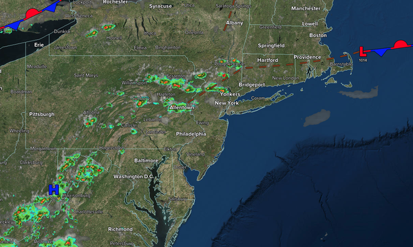
A cold front will continue to press southeastward with scattered clouds and isolated thunderstorms. Winds will be from the southwest at 5 to 10 mph. Low temperatures will range from the upper 60s to lower 70s over the interior, lower to mid-70s in the suburbs, and upper 70s to lower 80s in urban areas.
TOMORROW
A cold front will stall over the region with scattered showers and thunderstorms in the morning, becoming widespread in the afternoon. The thunderstorms will be capable of heavy downpours, frequent lightning, and wind gusts over 40 mph. Flooding will be a threat. Winds will be from the northeast at 1 to 5 mph. High temperatures will range from the upper 70s to the mid-80s over the interior, from the mid to upper 80s in the New York
City metropolitan area, and from the lower to mid-90s in the Philadelphia metropolitan area.
TOMORROW NIGHT
An area of low pressure will develop along the stalled front with widespread showers and thunderstorms. The thunderstorms will be capable of heavy downpours, frequent lightning, and wind gusts over 40 mph. Flooding is a
threat. Winds will be from the northeast at 5 to 10 mph. Low temperatures will range from the lower to mid-60s over the interior, mid to upper 60s in the suburbs, and upper 60s to lower 70s in urban areas.
FRIDAY
An area of low pressure along the cold front will produce periods of heavy rainfall in the morning. Flooding
will be a threat. Skies will clear with a few lingering showers in the afternoon. Winds will be from the northeast at 5 to 15 mph. High temperatures will range from the upper 60s to lower 70s over the interior and lower to mid-70s along the coast.
SATURDAY
High pressure will produce scattered clouds. Winds will be
from the northeast at 5 to 15 mph. Low temperatures will range from the mid-50s to the upper 50s over the interior, from the upper 50s to the lower 60s in the suburbs, and from the lower to mid-60s in urban areas. High temperatures will range from the lower to mid-70s over the interior and mid to upper 70s along the coast.
SUNDAY
High pressure will produce scattered clouds. Low temperatures will range from the mid-50s to the upper 50s over the interior and from the lower to mid-60s along the coast. High temperatures will range from the mid to upper 70s over the interior and upper 70s to the lower 80s along the coast.
MONDAY
High pressure will produce scattered clouds. Low temperatures will range from the mid-50s to the upper 50s over the interior and from the lower to mid-60s along the coast. High temperatures will range from the mid to upper 70s.
TUESDAY
High pressure will produce scattered clouds. Low
temperatures will range from the mid-50s to the upper 50s over the interior and from the lower to mid-60s along the coast. High temperatures will range from the mid to upper 70s over the interior and upper 70s to the lower 80s along the coast.
WEDNESDAY
A cold front will produce scattered showers and isolated thunderstorms. Low
temperatures will range from the lower to mid-60s over the interior and mid to upper 60s along the coast. High temperatures will range from the lower to mid-70s along the coast and mid to upper 70s elsewhere.