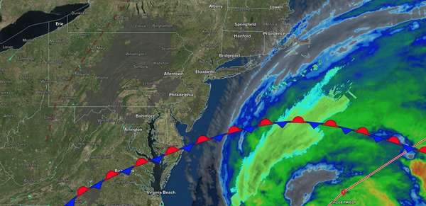
Conditions will slowly improve as Erin moves away, with lingering coastal flood issues declining by tomorrow. Excellent weather is expected by the weekend!
TONIGHT
High pressure will build into the region with clearing
skies. Winds will be from the northeast at 5 to 15 mph, with gusts up to 30 mph. Low temperatures will range from the lower to mid-50s over the interior, mid to upper 50s in the suburbs, and upper 50s to lower 60s in urban areas.
TOMORROW
High pressure will produce clear skies. Winds will be from the north at 5 to 15 mph
with gusts up to 30 mph along the coast. High temperatures will range from the mid to upper 70s over the interior and upper 70s to lower 80s along the coast.
TOMORROW NIGHT
High pressure will produce scattered clouds. Winds will be from the southwest at 1 to 5 mph. Low temperatures will range from the lower to mid-60s over
the interior and mid to upper 60s along the coast.
SATURDAY
High pressure will produce scattered clouds. Winds will be from the southwest at 5 to 10 mph. High temperatures will range from the upper 70s to lower 80s over the interior, lower to mid-80s on the I-95 corridor, and upper 70s to lower 80s along the
coast.
SUNDAY
A trough will produce scattered clouds and isolated thunderstorms by the evening. Winds will be from the south at 5 to 10 mph. Low temperatures will range from the lower to mid-60s over the interior and mid to upper 60s along the coast. High temperatures will range from the mid to upper 70s over the interior,
lower to mid-80s on the I-95 corridor, and upper 70s to lower 80s along the coast.
MONDAY
A cold front will produce scattered showers and thunderstorms. Low temperatures will range from the mid to upper 60s. High temperatures will range from the mid to upper 70s over the interior, lower to mid-80s on the I-95 corridor, and upper
70s to lower 80s along the coast.
TUESDAY
A trough will produce scattered clouds and isolated showers. Low temperatures will range from the mid to upper 50s over the interior, upper 50s to lower 60s in the suburbs, and lower to mid-60s in urban areas. High temperatures will range from the lower to mid-70s over the interior, upper
70s to lower 80s on the I-95 corridor, and mid to upper 70s along the coast.
WEDNESDAY
A trough will produce scattered clouds and isolated showers. Low temperatures will range from the lower to mid-50s over the interior and upper 50s to lower 60s along the coast. High temperatures will range from the lower to mid-70s over the
interior and upper 70s to lower 80s along the coast.
THURSDAY
A trough will produce scattered clouds and isolated showers. Low temperatures will range from the lower to mid-50s over the interior and upper 50s to lower 60s along the coast. High temperatures will range from the lower to mid-70s over the interior, lower to mid-70s
on the I-95 corridor, and upper 70s to lower 80s along the coast.