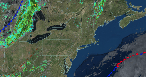
A series of cold fronts will bring the threat of showers and thunderstorms to the region tomorrow through Saturday. A cool, dry weather pattern returns by Sunday.
TONIGHT
High pressure will exit the region with scattered
clouds. Winds will be from the south at 1 to 5 mph. Low temperatures will range from the upper 50s to lower 60s over the interior and lower to mid-60s along the coast.
TOMORROW
A trough will approach the region with scattered clouds and isolated showers. Winds will be from the south at 5 to 15 mph. High temperatures
will range from the mid to upper 70s over the interior, lower to mid-80s on the I-95 corridor, and mid to upper 70s along the coast.
TOMORROW NIGHT
A trough will produce variable clouds and scattered showers. Winds will be from the south at 5 to 15 mph. Low temperatures will range from the lower to mid-60s over the interior and
mid to upper 60s along the coast.
FRIDAY
A trough will pass through the region with scattered clouds and isolated showers. Winds will be from the south at 5 to 15 mph. High temperatures will range from the mid to upper 70s, lower to mid-80s on the I-95 corridor, and upper 70s to lower 80s along the
coast.
SATURDAY
A cold front will produce scattered showers and thunderstorms in the afternoon and evening. Winds will be from the south at 5 to 15 mph. Low temperatures will range from the lower to mid-60s over the interior, mid to upper 60s in the suburbs, and upper 60s to lower 70s in urban areas. High temperatures will
range from the lower to mid-80s over the interior, upper 80s to the lower 90s on the I-95 corridor, and lower to mid-80s along the coast.
SUNDAY
High pressure will produce scattered clouds. Low temperatures will range from the lower to mid-50s over the interior, upper 50s to lower 60s in the Delaware River Valley, and lower to mid-60s
along the coast. High temperatures will range from the mid to upper 60s over the interior and lower to mid-70s along the coast.
MONDAY
High pressure will produce scattered clouds. Low temperatures will range from the mid to upper 40s over the interior, lower to mid-50s in the suburbs, and mid to upper 50s in urban areas.
High temperatures will range from the mid to upper 60s over the interior and lower to mid-70s along the coast.
TUESDAY
High pressure will produce scattered clouds. Low temperatures will range from the mid to upper 40s over the interior, lower to mid-50s in the suburbs, and mid to upper 50s in urban areas. High temperatures will
range from the mid to upper 60s over the interior and lower to mid-70s along the coast.
WEDNESDAY
High pressure will produce scattered clouds. Low temperatures will range from the mid to upper 40s over the interior, lower to mid-50s in the suburbs, and upper 50s to lower 60s in urban areas. High temperatures will range from the
upper 60s to lower 70s over the interior, mid to upper 70s on the I-95 corridor, and lower to mid-70s along the coast.