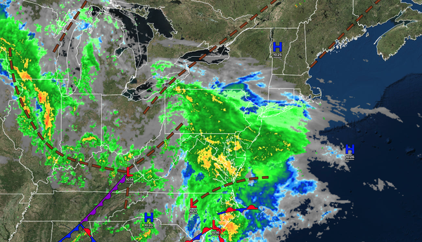
Rain will slowly push northward today as a low-pressure system approaches. Another wave of widespread rainfall can be expected by Friday night. A gradual shift to warmer weather will follow by next week.
TODAY
An
area of low pressure will approach the region with periods of rain in the Philadelphia metropolitan area and scattered showers developing in the afternoon over the New York City metropolitan area and the interior. Winds will be from the southeast at 5 to 15 mph. High temperatures will range from the mid to upper 50s over the interior, upper 50s to lower 60s in the Philadelphia metropolitan area, and lower to mid-60s in the New York City metropolitan
area.
TONIGHT
An area of low pressure will produce periods of rain. Winds will be from the southeast at 5 to 15 mph. Low temperatures will fall into the lower to mid-50s over the interior and mid to upper 50s along the coast.
TOMORROW
A stationary front will produce variable clouds and widely scattered showers. Winds will be from the southwest at 5 to 15 mph. High temperatures will rise into the mid to upper 60s on Long Island, upper 60s to lower 70s along the coast, lower to mid-70s in the Delaware River Valley, and upper 60s to lower 70s over the
interior.
TOMORROW NIGHT
A stationary front will produce variable clouds and isolated showers. Winds will be from the southwest at 5 to 15 mph. Low temperatures will range from the mid to upper 50s over the interior and upper 50s to lower 60s along the coast.
FRIDAY
A stationary front will produce variable clouds and isolated showers in the morning. An area of low pressure will approach the region with periods of rain developing in the evening. Winds will be from the northwest at 1 to 15 mph. High temperatures will range from the mid-60s to the lower 70s over the interior, mid to upper 70s in the Delaware
River Valley, and lower to mid-70s along the coast.
SATURDAY
The area of low pressure will exit the region with periods of rain in the morning, followed by gradual clearing towards evening. Winds will be from the west at 5 to 15 mph. Low temperatures will range from the lower to mid-50s over the interior and upper 50s to lower
60s along the coast. High temperatures will range from the lower to mid-60s over the interior and upper 60s to lower 70s along the coast.
SUNDAY
A trough will produce scattered clouds and isolated showers. Low temperatures will range from the mid to upper 40s over the interior, upper 40s to lower 50s in the suburbs, and lower to
mid-50s in urban areas. High temperatures will range from the mid to upper 50s over the interior and lower to mid-60s along the coast.
MONDAY
High pressure will produce scattered clouds. Low temperatures will range from the lower to mid-40s over the interior and upper 40s to lower 50s along the coast. High temperatures will
range from the lower to mid-60s over the interior, upper 60s to lower 70s in the Delaware River Valley, and mid to upper 60s along the coast.
TUESDAY
High pressure will produce scattered clouds. Low temperatures will range from the mid to upper 40s over the interior and upper 40s to lower 50s along the coast. High temperatures
will range from the lower to mid-70s.
WEDNESDAY
High pressure will produce scattered clouds. Low temperatures will range from the lower to mid-50s. High temperatures will range from the mid to upper 70s over the interior, mid to upper 70s along the coast, and upper 70s to lower 80s in the Delaware River
Valley.