Hot weather conditions take hold through tomorrow with temperatures in the 80s and 90s. Thunderstorms will return on Saturday, but the weekend won't be a washout.
TODAY
High pressure will produce scattered clouds.
Winds will be from the southwest at 5 to 10 mph. High temperatures will range from the lower to mid-80s on Long Island, mid to upper 80s on the coast, upper 80s to mid-90s on the I-95 corridor, and mid to upper 80s over the interior.
TONIGHT
High pressure will produce scattered clouds. Winds will be from the southwest at 5 to 10
mph. Low temperatures will range from the lower to mid-60s.
TOMORROW
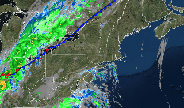
A cold front will slowly sink over the interior with variable clouds and widely scattered thunderstorms over the northern interior. Scattered clouds with isolated thunderstorms can be expected along the coast. Winds will be from the southwest at 5 to 10
mph. High temperatures will range from the upper 70s to lower 80s on Long Island, mid to upper 80s along the coast, upper 80s to lower 90s on the I-95 corridor, and upper 70s to mid-80s over the interior.
TOMORROW NIGHT
A stationary front will produce cloudy skies and isolated showers over the northern interior. Scattered
clouds will be found along the coast. Winds will be from the southwest at 5 to 10 mph. Low temperatures will range from the lower to mid-60s.
SATURDAY
A cold front will produce scattered showers and thunderstorms. Winds will be from the southwest at 5 to 10 mph. High temperatures will range from the mid to upper 70s
along the coast, upper 70s to lower 80s on the I-95 corridor, and mid to upper 70s along the interior.
SUNDAY
A warm front will approach with increasing clouds and scattered showers towards evening. Winds will veer to the east at 5 to 15 mph. Low temperatures will range from the lower to mid-50s over the interior, upper 50s to
lower 60s in the suburbs, and lower to mid-60s in urban areas. High temperatures will range from the mid to upper 70s along the coast, upper 70s to lower 80s on the I-95 corridor, and mid to upper 70s over the interior.
MONDAY
A warm front will move through the region with widely scattered showers. Low temperatures will range
from the upper 50s to lower 60s over the interior, upper 50s to lower 60s in the suburbs, and lower to mid-60s in urban areas. High temperatures will range from the lower to mid-70s.
TUESDAY
A cold front will move through the region with scattered showers and thunderstorms. Low temperatures will range from the lower to
mid-60s. High temperatures will range from the upper 60s to lower 70s on Long Island, lower to mid-70s along the coast, upper 70s to lower 80s on the I-95 corridor, and mid to upper 70s over the interior.
WEDNESDAY
High pressure will produce scattered clouds. Low temperatures will range from the mid to upper 50s over the interior
and lower to mid-60s along the coast. High temperatures will range from the lower to mid-70s over the interior, upper 70s to lower 80s on the I-95 corridor, and upper 70s to lower 80s along the coast.
THURSDAY
High pressure will produce scattered clouds. Low temperatures will range from the mid to upper 50s over the interior and
lower to mid-60s along the coast. High temperatures will range from the mid to upper 70s over the interior, upper 70s to lower 80s along the coast, and lower to mid-80s on the I-95 corridor.