UPDATED 01/11/26 10:22 AM
Cold air is returning with temperatures falling through the 40s and 30s this afternoon, with even a few snow showers!
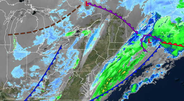
TODAY
A series of troughs will pass through the region with scattered clouds and flurries. Winds will be from the west at 5 to 15 mph. High temperatures will range from the lower to mid-30s over the interior and upper 30s to lower 40s along the coast in the late morning hours, and then fall through the 30s this afternoon and evening.
TONIGHT
High pressure will produce scattered clouds. Winds will be from the west at 5 to 15 mph. Low temperatures will range from the lower to mid-20s over the interior and mid to upper 20s along the coast.
TOMORROW
High pressure will produce scattered clouds. Winds will be from the west at 5 to 15 mph. High temperatures will range from the lower to mid-30s over the interior and upper 30s to lower 40s along the coast.
TOMORROW NIGHT
High pressure will produce scattered clouds. Winds will be from
the southwest at 5 to 15 mph. Low temperatures will range from the mid to upper 20s over the interior and upper 20s to lower 30s along the coast.
TUESDAY
High pressure will produce scattered clouds. Winds will be from the southwest at 5 to 15 mph. High temperatures will range from the lower to
mid-40's.
WEDNESDAY
A cold front will approach the region with increasing clouds and isolated showers. Winds will be from the southwest at 5 to 15 mph. Low temperatures will range from the lower to mid-30s over the interior and upper 30s to lower 40s along the coast. High temperatures will range from the mid to upper
40s.
THURSDAY
An arctic cold front will produce rain and snow showers. Low temperatures will range from the lower to mid-30s over the interior and mid to upper 30s along the coast. High temperatures will range from the upper 30s to lower 40s over the interior and mid to upper 40s along the coast.
FRIDAY
An area of low pressure will produce scattered snow showers. Low temperatures will range from the single digits to the lower 10s over the interior, mid to upper 10s in the suburbs, and lower to mid-20s in urban areas. High temperatures will range from the lower to mid-20s over the interior and upper 20s to lower 30s along the
coast.
SATURDAY
A trough will produce scattered clouds and flurries. Low temperatures will range from the lower to mid-20s over the interior and mid to upper 20s along the coast. High temperatures will range from the mid to upper 30s over the interior and lower to mid-40s along the coast.
SUNDAY
High pressure will produce scattered clouds. Low temperatures will range from the lower to mid-10s over the interior and upper 10s to lower 20s along the coast. High temperatures will range from the lower to mid-30s over the interior and upper 30s to lower 40s along the coast.