Excellent weather will continue through today, while clouds increase. A powerful cold front will bring heavy rain and strong winds to the region just in time for tomorrow morning's rush hour. An active weather pattern continues through the upcoming week.
TODAY
High pressure will exit the region with increasing clouds. Winds will increase from the south to 5 to 15 mph, 10 to 20 mph by the afternoon. High temperatures will range from the mid to upper 60s over the interior, lower to mid-70s along the I-95 corridor, and mid to upper 60s along the coast.
TONIGHT
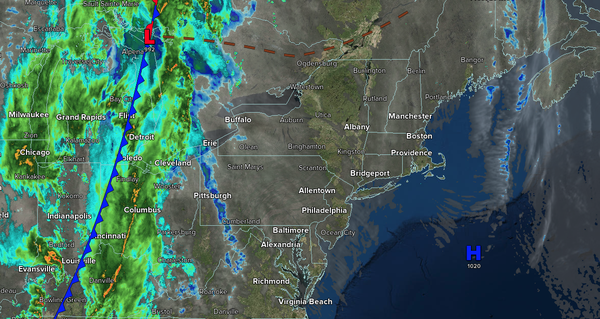
A cold front will approach with increasing clouds and developing rainfall after midnight. Winds will veer from the south to the west at 10 to 20 mph. Low temperatures will range from the upper 40s to the lower 50s over the interior, mid to upper 50s along the Delaware River Valley, and upper 50s to lower 60s along the
coast.
TOMORROW
A cold front and an area of low pressure will produce periods of rain through the early afternoon. Winds will veer to the west at 10 to 20 mph, with gusts over 30 mph. High temperatures will range from the mid to upper 50s over the interior and lower to mid-60s along the coast.
TOMORROW NIGHT
A series of troughs will produce scattered clouds and isolated showers. Winds will be from the south at 5 to 15 mph. Low temperatures will range from the lower to mid-40s over the interior and mid to upper 40s along the coast.
TUESDAY
A series of troughs will produce scattered clouds and isolated showers. Winds will be from the south at 5 to 15 mph. High temperatures will range from the lower to mid-60s over the interior, mid to upper 60s along the I-95 corridor, and lower to mid-60s along the coast.
WEDNESDAY
A cold front will produce periods of showers. Winds will veer to the west at 5 to 15 mph. Low temperatures will range from the mid to upper 40s over the interior, upper 40s to lower 50s in the suburbs, and lower to mid-50s in urban areas. High temperatures will range from the mid to upper 50s over the interior and from the upper 50s to the lower
60s along the coast.
THURSDAY
A series of troughs will produce scattered clouds and isolated showers. Low temperatures will range from the lower to mid-40s over the interior and mid to upper 40s along the coast. High temperatures will range from the mid to upper 50s over the interior and from the upper 50s to the lower 60s along
the coast.
FRIDAY
A series of troughs will produce scattered clouds and isolated showers. Low temperatures will range from the lower to mid-40s. High temperatures will range from the mid to upper 50s over the interior and from the upper 50s to the lower 60s along the coast.
SATURDAY
High pressure will produce scattered clouds. Low temperatures will range from the lower to mid-40s. High temperatures will range from the mid to upper 50s over the interior, lower to mid-60s along the I-95 corridor, and upper 50s to lower 60s along the coast.
SUNDAY
High pressure will slowly exit with increasing clouds. Low temperatures will range from the lower to mid-30s over the interior, upper 30s to lower 40s in the suburbs, and lower to mid-40s in urban areas. High temperatures will range from the lower to mid-50s over the interior, upper 50s to lower 60s along the I-95 corridor, and mid to upper 50s along the
coast.