UPDATED 03/21/26 10:01 AM
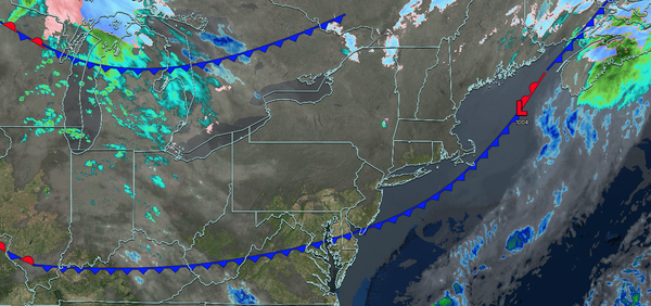
Skies will clear today with tranquil conditions through tomorrow morning. Another round of rainfall is expected tomorrow evening through Monday, with some localized urban and small-stream flooding.
TODAY
High pressure will build into the region with scattered clouds. Winds will veer to the southwest at 1 to 5 mph. High temperatures will range from the mid to upper 40s over the interior, lower to mid-50s in the New York City metropolitan area, and mid to upper 50s in the Philadelphia metropolitan area.
TONIGHT
High pressure will produce scattered clouds. Winds will back to the southeast at 5 to 10 mph. Low temperatures will range from the upper 30s to the lower 40s.
TOMORROW
A cold front will approach the
region with increasing clouds. Showers will develop in the evening and overnight hours. Winds will be from the southwest at 5 to 15 mph. High temperatures will range from the lower to mid-50s on eastern Long Island, upper 50s to lower 60s on western Long Island, mid to upper 60s over the interior and New York City metropolitan area, and upper 60s to lower 70s in the Philadelphia metropolitan area.
TOMORROW NIGHT
A cold front and an area of low pressure will approach the region with periods of rain. Winds will be from the southwest at 5 to 15 mph. Low temperatures will range from the lower to mid-30s over the higher elevations, upper 30s to lower 40s over the interior, mid to upper 40s in the New York City metropolitan area, and upper 40s to lower 50s in
the Philadelphia metropolitan area.
MONDAY
A cold front with an area of low pressure will produce periods of showers. Winds will veer to the northwest at 5 to 15 mph. High temperatures will range from the upper 30s to mid-40s over the interior, upper 40s to mid-50s in the New York City metropolitan area, and upper 50s to lower
60s in the Philadelphia metropolitan area.
TUESDAY
High pressure will produce scattered clouds. Winds will back to the southwest at 5 to 15 mph. Low temperatures will range from the lower to mid-20s over the interior and upper 20s to lower 30s along the coast. High temperatures will range from the lower to mid-40s over the
interior and mid to upper 40s along the coast.
WEDNESDAY
A cold front will pass through the region with scattered showers. Low temperatures will range from the mid to upper 30s. High temperatures will range from the upper 30s to lower 40s over the interior, mid to upper 40s in the New York City metropolitan area, and upper 40s to
lower 50s in the Philadelphia metropolitan area.
THURSDAY
High pressure will produce scattered clouds. Low temperatures will range from the mid to upper 10s over the interior and lower to mid-20s along the coast. High temperatures will range from the upper 30s to lower 40s over the interior and lower to mid-40s along the
coast.
FRIDAY
A cold front will produce periods of showers. Low temperatures will range from the lower to mid-30s over the interior and mid to upper 30s along the coast. High temperatures will range from the mid to upper 40s over the interior and lower to mid-50s along the coast.
SATURDAY
High pressure will build into the region with clearing skies. Low temperatures will range from the mid to upper 20s over the interior, lower to mid-30s in the suburbs, and mid to upper 30s along the coast and urban areas. High temperatures will range from the lower to mid-40s over the interior, mid to upper 40s in the New York City metropolitan area,
and lower to mid-50s in the Philadelphia metropolitan area.