UPDATED 03/22/26 10:34 AM
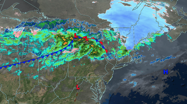
An approaching cold front will produce waves of rainfall and embedded thunderstorms this evening through tomorrow morning. Some flooding and strong wind gusts will be a threat, producing poor travel conditions.
TODAY
A cold front will approach the region with increasing clouds. Showers will develop in the evening and overnight hours. Winds will be from the southwest at 5 to 15 mph. High temperatures will range from the lower to mid-50s on eastern Long Island, upper 50s to lower 60s on western Long Island, mid to upper 60s over the interior and New York City
metropolitan area, and upper 60s to lower 70s in the Philadelphia metropolitan area.
TONIGHT
A cold front and an area of low pressure will approach the region with periods of rain and embedded thunderstorms. Winds will be from the southwest at 5 to 15 mph. Low temperatures will range from the lower to mid-30s over the higher
elevations, upper 30s to lower 40s over the interior, mid to upper 40s in the New York City metropolitan area, and upper 40s to lower 50s in the Philadelphia metropolitan area.
TOMORROW
A cold front with an area of low pressure will produce periods of showers in the morning. Scattered clouds are expected tomorrow afternoon. Winds
will veer to the northwest at 5 to 15 mph. High temperatures will range from the upper 30s to mid-40s over the interior, upper 40s to mid-50s in the New York City metropolitan area, and upper 50s to lower 60s in the Philadelphia metropolitan area.
TOMORROW NIGHT
High pressure will produce scattered clouds. Winds will back to the
southwest at 5 to 15 mph. Low temperatures will range from the lower to mid-20s over the interior and upper 20s to lower 30s along the coast.
TUESDAY
High pressure will produce scattered clouds. Winds will back to the southwest at 5 to 15 mph. High temperatures will range from the lower to mid-40s over the interior and mid
to upper 40s along the coast.
WEDNESDAY
A cold front will pass through the region with scattered clouds and isolated showers. Winds will be from the southwest at 5 to 15 mph. Low temperatures will range from the mid to upper 30s. High temperatures will range from the upper 30s to lower 40s over the interior, mid to upper
40s in the New York City metropolitan area, and upper 40s to lower 50s in the Philadelphia metropolitan area.
THURSDAY
High pressure will produce scattered clouds. Low temperatures will range from the mid to upper 10s over the interior and lower to mid-20s along the coast. High temperatures will range from the upper 30s to lower
40s over the interior and lower to mid-40s along the coast.
FRIDAY
A cold front will produce periods of showers. Low temperatures will range from the lower to mid-30s over the interior and mid to upper 30s along the coast. High temperatures will range from the mid to upper 40s over the interior and lower to mid-50s along the
coast.
SATURDAY
High pressure will build into the region with clearing skies. Low temperatures will range from the mid to upper 20s over the interior, lower to mid-30s in the suburbs, and mid to upper 30s along the coast and urban areas. High temperatures will range from the lower to mid-40s over the interior, mid to upper 40s in
the New York City metropolitan area, and lower to mid-50s in the Philadelphia metropolitan area.
SUNDAY
A cold front will produce variable clouds and isolated showers. Low temperatures will range from the upper 20s to lower 30s over the interior and lower to mid-30s along the coast. High temperatures will range from the upper 40s
to lower 50s over the interior, lower to mid-50s in the New York City metropolitan area, and upper 50s to lower 60s in the Philadelphia metropolitan area.