UPDATED 03/24/26 9:22 AM
Tranquil conditions return through mid-week, but periods of rain are likely by Friday. Dry but cool weather returns for the weekend.
TODAY
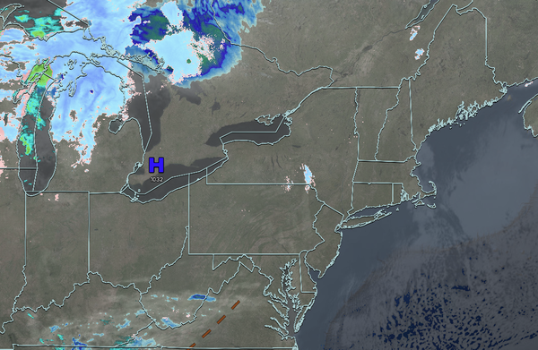
High pressure will produce scattered clouds. Winds will back to the southwest at 5 to 15 mph. High temperatures will range from the lower to mid-40s over the interior and mid to upper 40s along the coast.
TONIGHT
High pressure will exit the region with scattered clouds. Winds will be
from the southwest at 5 to 15 mph. Low temperatures will range from the upper 20s over the interior, upper 20s to lower 30s in the suburbs, and lower to mid-30s in urban areas.
TOMORROW
A trough will produce scattered clouds. Winds will be from the southwest at 5 to 15 mph. High temperatures will range from the mid to upper
40s over the interior, upper 40s to lower 50s in the New York City metropolitan areas, and lower to mid-50s in the Philadelphia metropolitan areas.
TOMORROW NIGHT
High pressure will produce scattered clouds. Winds will be from the southwest at 5 to 15 mph. Low temperatures will range from the mid to upper 40s over the interior
and suburbs and upper 40s to lower 50s in urban areas.
THURSDAY
High pressure will produce scattered clouds. Winds will be from the southwest at 5 to 15 mph. High temperatures will range from the lower to mid-60s on southern and eastern Long Island, mid to upper 60s over the interior, and upper 60s to lower 70s
elsewhere.
FRIDAY
A cold front will produce periods of showers. Winds will veer from the southwest to the northwest at 5 to 15 mph. Low temperatures will range from the mid to upper 30s in higher elevations, lower to mid-40s over the rest of the interior, mid to upper 40s in the New York City metropolitan areas, and upper 40s to
lower 50s in the Philadelphia metropolitan areas. High temperatures will range from the lower to mid-40s in higher elevations, upper 40s to lower 50s over the interior, and mid to upper 50s along the coast.
SATURDAY
High pressure will build into the region with clearing skies. Low temperatures will range from the lower to mid-20s
over the interior and upper 20s to lower 30s along the coast. High temperatures will range from the mid to upper 30s over the interior, upper 30s to lower 40s in the New York City metropolitan area, and lower to mid-40s in the Philadelphia metropolitan area.
SUNDAY
A trough will produce scattered clouds. Low temperatures will
range from the lower to mid-20s over the interior and upper 20s to the lower 30s along the coast. High temperatures will range from the lower to mid-40s on Long Island, mid to upper 40s in the New York City metropolitan area and interior, and upper 40s to lower 50s in the Philadelphia metropolitan area.
MONDAY
A cold front will produce
periods of showers. Low temperatures will range from the upper 30s to the lower 40s. High temperatures will range from the upper 50s to the lower 60s over the interior and the New York City metropolitan area, and from the mid to upper 60s in the Philadelphia metropolitan area.
TUESDAY
High pressure will produce scattered
clouds. Low temperatures will range from the lower to mid-20s over the interior, mid to upper 20s in the suburbs, and upper 20s to lower 30s in urban areas. High temperatures will range from the mid to upper 30s over the interior and lower to mid-40s along the coast.