UPDATED 03/27/26 9:20 AM
Periods of showers this morning will give way to dry but chilly conditions this evening through the weekend. A volatile weather pattern continues into next week.
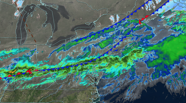
TODAY
A cold front will drop off the coast with lingering showers through early this afternoon. Scattered clouds are expected this evening. Winds will be from the northwest at 5 to 15 mph. High temperatures will range from the lower to mid-40s over the interior and from the upper 40s to the lower 50s along the coast.
TONIGHT
High pressure will build into the region with clearing skies. Winds will be from the northwest at 5 to 15 mph. Low temperatures will range from the upper 10s to the lower 20s over the interior, mid to upper 20s in the suburbs, and upper 20s to lower 30s in urban areas.
TOMORROW
High pressure will produce scattered clouds. Winds will be from the northwest at 5 to 15 mph. High temperatures will range from the mid to upper 30s over the interior and lower to mid-40s along the coast.
TOMORROW NIGHT
High pressure will produce scattered clouds. Winds will back to the southwest at 5 to 15 mph. Low temperatures will range from the mid to upper 20s over the interior and upper 20s to lower 30s along the coast.
SUNDAY
High pressure will produce scattered clouds. Winds will be from the
southwest at 5 to 15 mph. High temperatures will range from the mid to upper 40s on Long Island, upper 40s to lower 50s over the interior and New York City metropolitan area, and lower to mid-50s in the Philadelphia metropolitan area.
MONDAY
A trough will produce scattered clouds. Winds will be from the southwest at 5 to 15
mph. Low temperatures will range from the upper 30s to lower 40s over the interior and mid to upper 40s along the coast. High temperatures will range from the lower to mid-60s over the interior and New York City metropolitan area and upper 60s to lower 70s in the Philadelphia metropolitan area.
TUESDAY
A warm front will lift
through the region with morning showers, followed by variable cloud cover. Low temperatures will range from the lower to mid-40s over the interior, mid to upper 40s in the suburbs, and upper 40s to lower 50s in urban areas. High temperatures will range from the mid to upper 50s on southeastern Long Island, lower to mid-60s in northwestern Long Island, mid to upper 60s over the interior, upper 60s to lower 70s in the New York City metropolitan area, and mid to upper 70s in the
Philadelphia metropolitan area.
WEDNESDAY
A cold front will approach with increasing clouds throughout the day, followed by showers and thunderstorms in the evening. Low temperatures will range from the mid to upper 40s over the interior, lower to mid-50s in the New York City metropolitan area, and upper 50s to lower 60s in the
Philadelphia metropolitan area. High temperatures will range from the mid-60s to the lower 70s over the interior, lower to mid-70s in the New York City metropolitan area, upper 60s to lower 70s in northwestern Long Island, mid to upper 60s in southeastern Long Island, and upper 70s to lower 80s in the Philadelphia metropolitan area.
THURSDAY
A cold front will move through the region with showers and thunderstorms in the morning, followed by clearing skies. Low temperatures will range from the upper 20s to lower 30s in higher elevations, lower to mid-30s over the interior, and upper 30s to lower 40s along the coast. High temperatures will range from the upper 40s to the lower 50s.
FRIDAY
An area of low pressure will produce periods of rain. Some freezing rain will be possible in higher elevations in the morning hours. Low temperatures will range from the upper 20s to the lower 30s in higher elevations and mid to upper 30s elsewhere. High temperatures will rane from the upper 30s to lower 40s over the interior and lower to mid-40s
along the coast.