UPDATED 04/03/26 9:45 AM
A battle among tropical, polar, and maritime air masses will keep conditions unsettled through the holiday weekend.
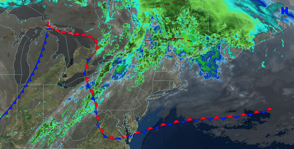
TODAY
A stationary front will rebound as a warm front with low clouds giving way to scattered clouds and isolated showers. Winds will veer from the northeast to the southwest at 5 to 15 mph. High temperatures will range from the upper 50s to lower 60s in southeastern Long Island, mid to upper 60s in northwestern Long Island, upper 60s to lower 70s along the coast, lower to mid-70s over the interior and New York City metropolitan area, and mid to upper
70s in the Philadelphia metropolitan area.
TONIGHT
A warm front will continue to lift to the north of the region with scattered clouds and isolated showers. Winds will be from the southwest at 5 to 15 mph. Low temperatures will range from the lower to mid-50s over the interior, mid to upper 50s in the suburbs, and upper 50s to
lower 60s in urban areas.
TOMORROW
A backdoor cold front will sink southeastward by the late afternoon with variable clouds, widely scattered showers, and isolated thunderstorms. Winds will back from the southwest to the northeast at 5 to 15 mph. High temperatures will range from the upper 60s to lower 70s over southeastern Long
Island, mid to upper 70s in northwestern Long Island, upper 70s to lower 80s in the New York City and Philadelphia metropolitan areas, and lower to mid-70s over the interior.
TOMORROW NIGHT
A stationary front will linger over the region with broken cloud cover and widely scattered showers. Winds will veer to the southwest at 5 to 15
mph. Low temperatures will range from the mid to upper 40s on Long Island and lower to mid-50s for the rest of the region.
EASTER SUNDAY
A cold front will approach with increasing clouds through the morning, followed by showers and thunderstorms by the afternoon. Winds will be from the southwest at 5 to 15 mph. High
temperatures will range from the upper 50s to lower 60s over the interior, upper 50s to lower 60s on Long Island, mid to upper 60s in the New York City metropolitan area, and upper 60s to lower 70s in the Philadelphia metropolitan area.
MONDAY
High pressure will produce scattered clouds. Winds will be from the west at 5 to 15
mph. Low temperatures will range from the lower to mid-30s over the interior and upper 30s to lower 40s along the coast. High temperatures will range from the mid to upper 40s over the interior, lower to mid-50s in the New York City metropolitan area, and mid to upper 50s in the Philadelphia metropolitan area.
TUESDAY
An area of
low pressure will approach with increasing clouds, followed by widely scattered showers in the afternoon. Low temperatures will range from the lower to mid-30s over the interior and upper 30s to lower 40s along the coast. High temperatures will range from the mid to upper 40s over the interior and lower to mid-50s along the coast.
WEDNESDAY
High pressure will produce scattered clouds. Low temperatures will range from the mid to upper 20s over the interior and lower to mid-30s along the coast. High temperatures will range from the mid to upper 40s on Long Island, upper 40s to lower 50s over the interior, and lower to mid-50s in the New York City and Philadelphia metropolitan areas.
THURSDAY
High pressure will produce scattered clouds. Low temperatures will range from the mid to upper 30s. High temperatures will range from the mid to upper 50s on Long Island, lower to mid-60s along the coast and interior, and mid to upper 60s in the Philadelphia and New York City metropolitan areas.
FRIDAY
A cold front will stall to the north of the region with scattered clouds and isolated showers over the interior. Low temperatures will range from the lower to mid-40s over the interior, mid to upper 40s in the suburbs, and upper 40s to lower 50s in the urban areas. High temperatures will range from the lower to mid-60s over southeastern Long Island, mid
to upper 60s in northwestern Long Island, lower to mid-70s over the interior and New York City metropolitan area, and mid to upper 70s in the Philadelphia metropolitan area.