UPDATED 04/05/26 9:21 AM
A strong cold front will produce waves of rainfall by this Easter afternoon. A chilly but sunny start to the new week is expected.
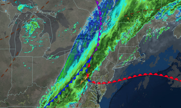
TODAY: EASTER
A cold front will approach with increasing clouds through the morning, followed by showers and thunderstorms by the afternoon. Winds will be from the southwest at 5 to 15 mph. High temperatures will range from the upper 50s to lower 60s over the interior, upper 50s to lower 60s on Long Island, mid to upper 60s in the New York City metropolitan area, and
upper 60s to lower 70s in the Philadelphia metropolitan area.
TONIGHT
High pressure will build into the region with clearing skies. Winds will veer to the west at 5 to 15 mph. Low temperatures will range from the lower to mid-30s over the interior and upper 30s to lower 40s along the coast.
TOMORROW
High pressure will produce scattered clouds. Winds will be from the west at 5 to 15 mph. High temperatures will range from the mid to upper 40s over the interior, lower to mid-50s in the New York City metropolitan area, and mid to upper 50s in the Philadelphia metropolitan area.
TOMORROW NIGHT
High pressure will exit the region with increasing clouds. Winds will be from the west at 5 to 15 mph. Low temperatures will range from the lower to mid-30s over the interior and upper 30s to lower 40s along the coast.
TUESDAY
An area of low pressure will produce widely scattered showers. Winds will veer to the northwest at 10 to 20 mph. High temperatures will range from the mid to upper 40s over the interior and lower to mid-50s along the coast.
WEDNESDAY
High pressure will produce scattered clouds. Winds
will be light and variable. Low temperatures will range from the mid to upper 20s over the interior and lower to mid-30s along the coast. High temperatures will range from the mid to upper 40s on Long Island, upper 40s to lower 50s over the interior, and lower to mid-50s in the New York City and Philadelphia metropolitan areas.
THURSDAY
High pressure will produce scattered clouds. Low temperatures will range from the mid to upper 30s. High temperatures will range from the mid to upper 50s on Long Island, lower to mid-60s along the coast and interior, and mid to upper 60s in the Philadelphia and New York City metropolitan areas.
FRIDAY
A cold front will stall to the north of the region with scattered clouds and isolated showers over the interior. Low temperatures will range from the lower to mid-40s over the interior, mid to upper 40s in the suburbs, and upper 40s to lower 50s in the urban areas. High temperatures will range from the lower to mid-60s over southeastern Long Island, mid to upper 60s in northwestern Long Island, lower to mid-70s over the interior and New York City
metropolitan area, and mid to upper 70s in the Philadelphia metropolitan area.
SATURDAY
A trough will produce isolated showers in the morning, followed by clearing skies. Low temperatures will range from the mid to upper 30s in the higher elevations, lower to mid-40s over the interior, upper 40s to lower 50s in the suburbs, and lower
to mid-50s in urban areas. High temperatures will range from the lower to mid-50s over the interior, upper 50s to lower 60s in the New York City metropolitan area, and lower to mid-60s in the Philadelphia metropolitan area.
SUNDAY
High pressure will produce scattered clouds. Low temperatures will range from the lower to mid-40s
on Long Island and mid to upper 40s elsewhere. High temperatures will range from the mid to upper 50s on Long Island and lower to mid-60s elsewhere.