UPDATED 02/18/26 9:40 AM
Waves of showers, cloudy skies, and fog will be a threat through the end of the week. A storm threat is becoming less likely on Sunday night.
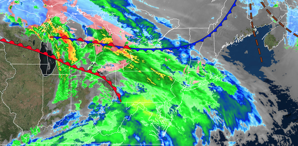
TODAY
A warm front will lift through the region with scattered clouds and areas of low clouds. Winds will be from the southwest at 5 to 15 mph. High temperatures will range from the lower to mid-40s over the interior, lower to mid-40s in the New York City metropolitan area, and upper 40s to the lower 50s in the Philadelphia metropolitan area.
TONIGHT
A warm front will lift northward with variable clouds and isolated showers. Winds will be from the west at 5 to 15 mph. Low temperatures will range from the lower to mid-30s.
TOMORROW
A trough will
produce scattered clouds and isolated rain/snow showers. Winds will be from the northwest at 1 to 5 mph. High temperatures will range from the upper 30s to lower 40s across the interior, from the upper 30s to lower 40s in the New York City metropolitan area, and from the lower to mid-40s in the Philadelphia metropolitan area.
TOMORROW NIGHT
A trough will produce scattered clouds and isolated rain/snow showers. Winds will be from the east at 5 to 15 mph. Low temperatures will range from the lower to mid-30s.
FRIDAY
An area of low pressure will approach the region with a wintry mix changing to rain over the interior and rain
elsewhere. Winds will be from the east at 5 to 15 mph. High temperatures will range from the upper 30s to lower 40s over the interior, upper 30s to lower 40s in the New York City metropolitan area, and lower to mid-40s in the Philadelphia metropolitan area.
SATURDAY
A trough will produce variable clouds and scattered
showers. Winds will be from the northwest at 5 to 15 mph. Low temperatures will range from the lower to mid-30s. High temperatures will rang efrom the upper 30s to lower 40s over the interior, lower to mid-40s in the New York City metropolitan area, and upper 40s to lower 50s in the Philadelphia metropolitan area.
SUNDAY
A
trough will produce scattered clouds and isolated rain/snow showers. An area of low pressure will develop well to the east of the region with scattered rain/snow showers in the evening. Low temperatures will range from the upper 20s to the lower 30s. High temperatures will range from the lower to mid-30s over the interior, mid to upper 30s in the New York City metropolitan area, and upper 30s to lower 40s in the Philadelphia metropolitan
area.
MONDAY
An area of low pressure will develop well to the east of the region with scattered rain/snow showers. Low temperatures will range from the lower to mid-20s over the interior and mid to upper 20s along the coast. High temperatures will range from the mid to upper 30s.
TUESDAY
High pressure will produce clear skies. Low temperatures will range from the lower to mid-10s over the interior, upper 10s to lower 20s in the suburbs, and lower to mid-20s in urban areas. High temperatures will range from the upper 30s to lower 40s over the interior, lower to mid-40s in the New York City metropolitan area, and mid to upper 40s in the
Philadelphia metropolitan area.
WEDNESDAY
High pressure will produce clear skies. Low temperatures will range from the lower to mid-10s over the interior, upper 10s to lower 20s in the suburbs, and lower to mid-20s in urban areas. High temperatures will range from the upper 30s to lower 40s over the interior, lower to mid-40s in
the New York City metropolitan area, and mid to upper 40s in the Philadelphia metropolitan area.