UPDATED 02/19/26 10:08 AM
Waves of showers, cloudy skies, and fog will be a threat through the end of the week. A major winter storm threat is becoming less likely on Sunday night, but minor to moderate impacts remain a threat with some accumulating snowfall.
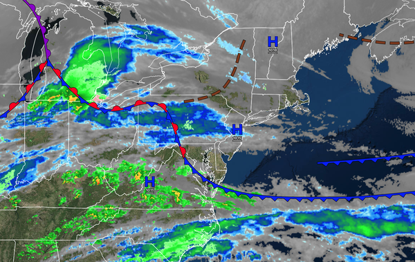
TODAY
A stationary front will produce variable clouds. Winds will be from the northwest at 1 to 5 mph. High temperatures will range from the upper 30s to lower 40s over the interior, upper 30s to lower 40s in the New York City metropolitan area, and lower to mid-40s in the Philadelphia metropolitan area.
TONIGHT
A warm front will lift through the region with a wintry mix developing over the interior and rain elsewhere. Winds will be from the east at 1 to 5 mph. Low temperatures will range from the lower to mid-30s over the interior and mid to upper 30s along the coast.
TOMORROW
The warm front will lift to the north of the region with the wintry mix changing over to rain over the interior and rain continuing elsewhere. Winds will be from the east at 5 to 15 mph. High temperatures will range from the upper 30s to lower 40s over the interior, upper 30s to lower 40s in the New York City metropolitan area, and mid to upper 40s in
the Philadelphia metropolitan area.
TOMORROW NIGHT
A trough will linger around the region with variable clouds and scattered rain/snow showers. Winds will veer to the northwest at 5 to 15 mph. Low temperatures will range from the lower to mid-30s.
SATURDAY
A trough will produce variable clouds and isolated showers. Winds will be from the northwest at 5 to 15 mph. High temperatures will range from the upper 30s to lower 40s over the interior, lower to mid-40s in the New York City metropolitan area, and mid to upper 40s in the Philadelphia metropolitan area.
SUNDAY
An area of low pressure will develop well to the southeast of the region, with a trough lingering over the region, producing variable clouds and scattered rain/snow showers. Winds will be from the northeast at 5 to 15 mph. Low temperatures will range from the upper 20s to lower 30s over the interior and lower to mid-30s along the coast. High
temperatures will range from the lower to mid-30s over the interior and mid to upper 30s along the coast.
MONDAY
An area of low pressure and an inverted trough will exit the region with morning snow showers. Skies will clear in the afternoon and evening. Low temperatures will range from the lower to mid-20s over the interior and
mid to upper 20s along the coast. High temperatures will range from the lower to mid-30s over the interior and mid to upper 30s along the coast.
TUESDAY
High pressure will produce clear skies. Low temperatures will range from the lower to mid-20s over the interior and mid to upper 20s along the coast. High temperatures will
range from the mid to upper 20s over the interior, lower to mid-30s in the New York City metropolitan area, and mid to upper 30s in the Philadelphia metropolitan area.
WEDNESDAY
High pressure will produce clear skies. Low temperatures will range from the lower to mid-20s. High temperatures will rang efrom the mid to upper 30s
over the interior, upper 30s to lower 40s in the New York City metropolitan area, and lower to mid-40s in the Philadelphia metropolitan area.
THURSDAY
An area of low pressure will produce snow and rain showers, changing over to rain showers. Low temperatures will range from the lower to mid-30s over the interior and upper 30s to lower
40s along the coast. High temperatures will range from the lower to mid-40s over the interior, mid to upper 40s in the New York City metropolitan area, and lower to mid-50s in the Philadelphia metropolitan area.