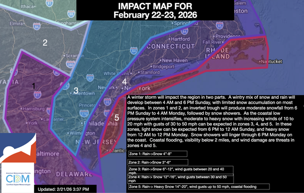
The primary bust potential for this storm is where the intense snow band sets up.
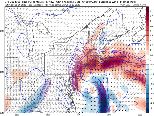
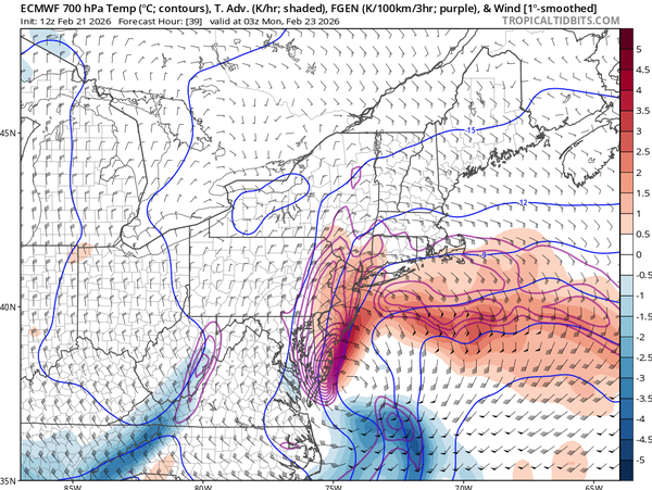
Many have asked why, in zone 3, I am going so low when many outlets, including the NWS, are going significantly higher. The answer comes down to rising and sinking motion.
If there are going to be snowfall rates of 1" to 4" per hour on the coast, then there must be an equal and opposite reaction. That reaction is experienced in many winter storms, and this one will be no different.
With an inverted trough over southeastern Pennsylvania tomorrow evening, enhancing snowfall totals in east-central Pennsylvania and lifting intensifying along the coast,
there must be an area of sinking air around the Delaware River Valley and northern New Jersey. However, some guidance pushes this banding further west, towards the Hudson Highlands and the Delaware Water Gap, which would expand the potential for intense snowfall rates. Still, the process remains, and that means sinking air will also shift to the west. My point is that some locations are going to have periods of very light snow, while locations to the east will experience
blizzard conditions. The question is not if, but simply where. Thus the bust potential in some of these locations away from the coast.
This is going to be a very complicated storm, and there is no doubt that this storm will produce intense snowfall. Regardless of whether you have 6", 12", or 24", this snow will be of the heavy, wet variety and very difficult to move. Please use caution when
shovelling.
Also, this storm will make travel conditions very poor tomorrow night through Monday morning. If possible, please do not travel and work from home. Visibility will be near zero, and wind gusts will create dangerous conditions. Let the people who bravely go out to clear up the streets for this storm do their job. Perhaps hand out some coffee for them while you are at
it.