UPDATED 03/03/26 9:40 AM
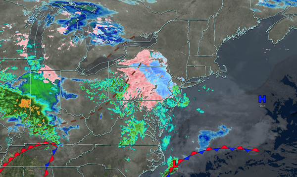
A wintry mix this morning will give way to waves of rainfall this afternoon. An unsettled weather pattern will continue through the week. Very warm conditions are expected by the weekend!
TODAY
A warm front will produce a wintry mix of snow, sleet, and rain this morning. The wintry mix will change over to rain by this afternoon. Winds will be from the south at 1 to 5 mph. High temperatures will range from the mid to upper 30s over the interior and lower to mid-40s along the coast.
TONIGHT
A stationary front will produce variable clouds and scattered showers. Winds will veer to the southwest at 5 to 10 mph. Low temperatures will range from the mid to upper 30s.
TOMORROW
A stationary
front will produce variable clouds and scattered showers. Winds will veer to the east at 5 to 10 mph. High temperatures will range from the lower to mid-50s.
TOMORROW NIGHT
A stationary front will linger over the region with variable clouds and scattered showers. Winds will be from the east at 1 to 5 mph. Low
temperatures will range from the upper 30s to the lower 40s.
THURSDAY
A stationary front will linger over the region with variable clouds and scattered showers. Winds will be from the east at 1 to 5 mph. High temperatures will range from the mid to upper 40s over the interior and Long Island, upper 40s to lower 50s in the New
York City metropolitan area, and mid to upper 50s in the Philadelphia metropolitan area.
FRIDAY
An area of low pressure along the stationary front will produce scattered to widespread showers in the morning. Skies will clear in the afternoon and evening. Winds will be from the northeast at 5 to 10 mph. Low temperatures will
range from the mid to upper 30s. High temperatures will range from the mid to upper 40s over the interior and upper 40s to lower 50s along the coast.
SATURDAY
A trough will produce scattered clouds and isolated showers. Low temperatures will range from the upper 30s to the lower 40s. High temperatures will range from the
lower to mid-50s on Long Island, upper 50s to lower 60s in the New York City metropolitan area, and lower to mid-60s over the interior and Philadelphia metropolitan area.
SUNDAY
A cold front will produce scattered showers in the morning. Skies will clear in the afternoon. Low temperatures will range from the upper 40s to lower
50s over the interior, lower to mid-50s in the suburbs, and mid to upper 50s in urban areas. High temperatures will range from the upper 50s to lower 60s over the interior and lower to mid-60s along the coast.
MONDAY
A trough will produce scattered clouds and isolated showers. Low temperatures will range from the lower to
mid-40s. High temperatures will range from the upper 50s to lower 60s over the interior, lower to mid-60s in the New York City metropolitan area, and mid to upper 60s in the Philadelphia metropolitan area.
TUESDAY
A trough will produce scattered clouds and isolated showers. Low temperatures will range from the lower to
mid-30s. High temperatures will range from the lower to mid-50s on Long Island, upper 50s to lower 60s in the New York City metropolitan area and interior, and mid to upper 60s in the Philadelphia metropolitan area.