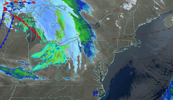
UPDATED 03/13/26 9:40 AM
Many consider Friday the 13th unlucky, but this time, many will note how chilly the weather turned after record-high temperatures over the past few days. An unsettled weather pattern will continue with a stormy Monday becoming very
likely.
TODAY
High pressure will produce scattered clouds. Winds will increase from the south at 10 to 20 mph with gusts up to 35 mph. High temperatures will range from the upper 30s to lower 40s over the interior, lower to mid-40s in the New York City metropolitan area, and upper 40s to lower 50s in the Philadelphia metropolitan
area.
TONIGHT
An area of low pressure will approach the region with increasing clouds and isolated showers. Winds will be from the southwest at 5 to 15 mph. Low temperatures will range from the lower to mid-30s over the interior and upper 30s to lower 40s for the coast.
TOMORROW
An area of low pressure will pass to the north of the region with variable clouds and isolated showers. Winds will be from the west at 10 to 20 mph. High temperatures will range from the upper 30s to lower 40s over the interior, mid to upper 40s in the New York City metropolitan area, and upper 40s to lower 50s in the Philadelphia metropolitan
area.
TOMORROW NIGHT
A warm front will approach the region with variable clouds. Winds will veer from the northwest to the northeast at 5 to 15 mph. Low temperatures will range from the mid to upper 20s over the interior and lower to mid-30s along the coast.
SUNDAY
A warm front will lift through the region with variable clouds and isolated showers. Winds will veer to the east at 5 to 15 mph with gusts up to 30 mph. High temperatures will range from the mid to upper 40s over the interior, upper 40s to lower 50s in the New York City metropolitan area, and lower to mid-50s in the Philadelphia metropolitan
area.
MONDAY
An area of low pressure with a warm front in the morning, followed by a cold front in the afternoon with produce waves of rainfall and embedded thunderstorms. Winds will be from the south at 10 to 20 mph with gusts over 30 mph. Low temperatures will range from the mid to upper 40s over the interior, upper 40s to
lower 50s in the suburbs, and lower to mid-50s in urban areas. High temperatures will range from the mid to upper 50s on Long Island, upper 50s to lower 60s over the interior and New York City metropolitan area, and mid to upper 60s in the Philadelphia metropolitan area.
TUESDAY
High pressure will build into the region with clearing
skies. Low temperatures will range from the mid to upper 20s over the interior and lower to mid-30s along the coast. High temperatures will range from the upper 20s to the lower 30s over the interior, the mid to upper 30s in the New York City metropolitan area, and the upper 30s to lower 40s in the Philadelphia metropolitan area.
WEDNESDAY
High pressure will produce scattered clouds. Low temperatures will range from the lower to mid-20s. High temperatures will range from the upper 30s to the lower 40s.
THURSDAY
High pressure will produce scattered clouds. Low temperatures will range from the upper 20s to the lower
30s. High temperatures will range from the mid to upper 40s over the interior, mid to upper 40s on Long Island, and upper 40s to lower 50s throughout the rest of the region.
FRIDAY
A warm front will approach the region with increasing clouds throughout the day. Periods of showers can be expected in the evening for most of the
region, and a wintry mix can be expected over the interior. High temperatures will range from the upper 30s to lower 40s over the interior, mid to upper 40s in the New York City metropolitan area, and upper 40s to lower 50s in the Philadelphia metropolitan area.